 |
Landslides at Karwar, October 2009 : Causes and Remedial Measures |
 |
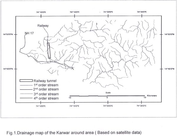
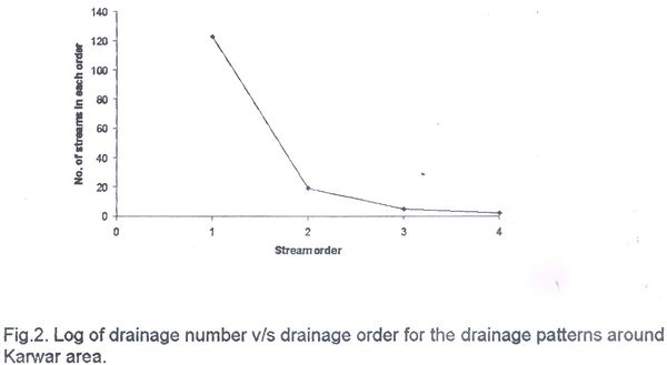
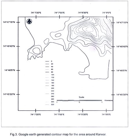
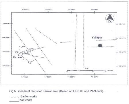
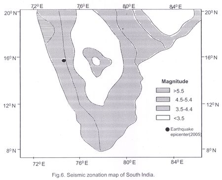
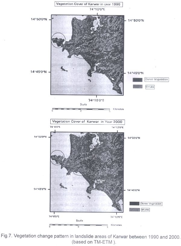
Annexure III: Report by Dr. V S Hegde, SDM College of Engineering, Dharwad Report of the site investigations of the land slides at Karwar 28-10-2009 Sri Ananth Hegde Ashisar Report of the site investigations of the land slides at Karwar Land slided area around Karwar was visited on 10-11-2009. During the visit, 21 locations have been visited. Location of the sites have been recorded using Garmin make GPS. Materials involved in sliding; topography, post slide slope have been investigated and pre-slide slope have been inferred based on the observations of the adjacent areas. Nature of slide has been studied and inferred based on the discussion with the local people. Man made structures have been investigated. In the laboratory contour map is generated based on the Google earth 2008; Drainage frequency map for the slided and surrounding area, vegetation change over the last 10 year; bifurcation analysis; lineaments patterns have been studied using PAN, Google earth, and LISS III images; based on the recent earth quakes records and previous works by other experts earth quake intensity distribution map has been prepared. Observations : Land slide at Kadwad and Karwar fishery port is classified as soil slide; road side near Karwar port it is rock fall; along the highway side it is soil and debris slide. Area is dominated by granites/granite gneisses that are moderately jointed. Only locally laterite capping is seen. Soil cover in the high way section is less where as near Kadwad it is very thick. Drainage frequency is low (Fig.1), bifurcation index is high for the lower orders (Table 1); first order show valley lengthening (Fig 2), hence erosion. West –East cross profiles show sudden rise in the landform gradient in the coastal belt (Fig 3) which is unusual in the coastal plains; Profiles across the river indicate terraces and entrenching; rivers tributaries show anomalous bends in the lower course; pebble beds (Fig 4) and raised terraces are observed near Belikaeri. All these points to neotectonic activities in the area. Area is affected by intensive quarrying; Rocks are quarried for road aggregate, for construction, etc; blasting appears to be the dominant mode involved in quarrying the rocks. This not only shatters the rocks, increases the intensity of the joints, widens the joints and sets up minor vibration in the rocks. To prevent drainage entry into sea bird project area compound walls constructed along the high way side are not provided with drainage. Natural drainages have been closed, leading to water logged in highway during high rain fall times; slope areas under/toe cutting is increased, resulted in land sliding and debris slides along hill side highway sections. There are many lineaments crossing the railway tracks (Fig 5). For railway line and other domestic works, hill slopes have been cut at higher angle than the angle of rest. During passage of train vibration sets, get converted into complex chains of vibration when the waves of vibrations reach the planes of non continuity defined by the joints/lineaments/ faults. Seismically the area comes under the high seismic risk zone. It is supported by the data of recent earth quakes (Fig 6). At many places, especially in landslide affected area, original forest has been degraded and in place shrubs are replacing the original vegetation (Fig 7). Conclusions : A scientific technical article based on the detail study of the landslide is underway. Fig.1.Drainagemap of the Karwar around area (Based on satellite data)
Table 1. Drainage statistics of Karwar area
Drainage Frequency
|

 Move to Annexure IV