| |
ENVIS Technical Report: 36, February 2012 |
 |
Grasslands of Anshi-Dandeli Tiger Reserve |
 |
|
|
GRASSLAND DENSITY IN THE WILDLIFE RANGES
Grasslands can be visually identified in the field during actual field work. Satellite imageries provide good overall idea about the grasslands in a specified area. In the Anshi-Dandeli Tiger Reserve, it is actually a difficult task to count exactly the number of grasslands. There are small grasslands, less than one hectare larger ones over six sq. km each. In addition are savanna grasslands everywhere where trees are sparse to closer ones which almost would appear like forest. Moreover, often fallow fields overgrown with various herbs and grasses also appear as grasslands. In general, a grassland can be defined as “Grass and other herbs dominating a landscape from which trees are scarce or absent” (Brewer, 1988). Using Google Earth imagery we have listed easily identifiable grasslands/forest openings/rice fields (including even fallow fields overgrown with herbs) of one sq. km and above in size occurring in the different Wild Life ranges of the ADTR (Table 6-1).
Table 6.1: Grassland/forest opening density in different Wild Life Ranges of ADTR
| Sl. |
Range |
1-3 Sq.km |
3-6 Sq.km |
6-9 Sq.km |
>9 Sq.km |
| 1 |
Diggi |
25 |
3 |
1 |
|
| 2 |
Kumbarwada |
20 |
7 |
3 |
2 |
| 3 |
Phansoli |
8 |
3 |
|
|
| 4 |
Kulgi |
5 |
2 |
0 |
|
| 5 |
Gund |
15 |
1 |
|
|
| 6 |
Anshi |
59 |
13 |
4 |
3 |
| 7 |
Kadra |
4 |
1 |
|
|
Anshi and Kumbarwada Ranges have some very large grasslands. Higher number of grasslands seen in Anshi range may be due to its larger range size and anthropogenic causes such as fields, either used or disused. Also the number of very small grasslands less than 1 sq km are more, although we have not listed them here. Details of forest Beats, Range-wise, having good grasslands are given in the Table 6-2.
Total number of beats having large number of grasslands are more in Anshi owing to, may be, its larger size. This is followed by Kumbarwada with 5 beats having large grasslands. Phansoli and Kulgi have the least (Table 6-2).
Table 6-2: Range-wise names of Beats having good grasslands/forest openings
| Beats |
Diggi |
Kumbarwada |
Phansoli |
Kulgi |
Gund |
Anashi |
| |
1 |
Kartoli |
Gundali |
Shidoli |
Ambga(W |
Kalane |
Tirval |
| 2 |
Kanangaon |
Teloli |
Chandrali |
Ambga(C) |
Tamange |
Nanevada |
| 3 |
Vageli |
Nujji |
|
|
Komba |
Anashi |
| 4 |
|
Kundal |
|
|
|
Kelimala |
| 5 |
|
Savant Matkarni |
|
|
Bhakhi |
| 6 |
|
|
|
|
|
Kailvada |
| 7 |
|
|
|
|
|
Kodugali |
| 8 |
|
|
|
|
|
Ulvi |
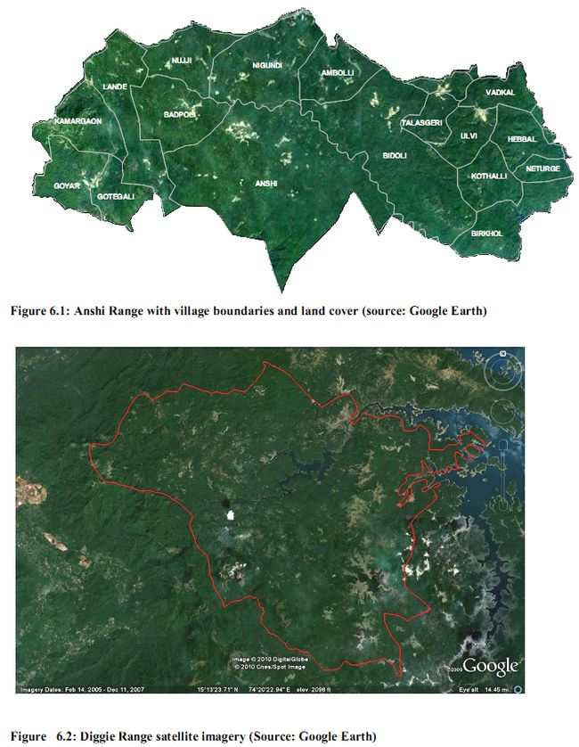
- Anshi Range: This Range with its vast area and diverse habitats contributes substantially towards the safety of wildlife. The Kali River towards its east runs in southerly direction and turns westwards; its course is quite near the southern boundary of the Anshi Range. Rise of water in the river due to the construction of Kodsalli dam has submerged good tiger habitats of rugged rocks and pockets of tall grass and other wild growth. Several small openings can be seen in the satellite imagery (Google), most of them are human inhabited areas and fields with bits and pieces of grasslands adjoining agriculture. There are also grassy blanks in the otherwise largely forest covered Range. Evergreen forest areas are not very suitable for grazing animals. Naturally, we cannot expect the tiger population to increase in this Range (Anshi National Park has only three tigers estimated). Nevertheless the grasslands here are very critical for ungulates and their predators. They need to be protected from forest succession, nor any plantation activities to be carried out in the grassy blanks. Grasslands require more management interventions, including the use of controlled fire and restriction of grazing by domestic animals. The resettlement of villages will turn many fields into grasslands, meadows and marshes enhancing landscape heterogeniety favouring wildlife.
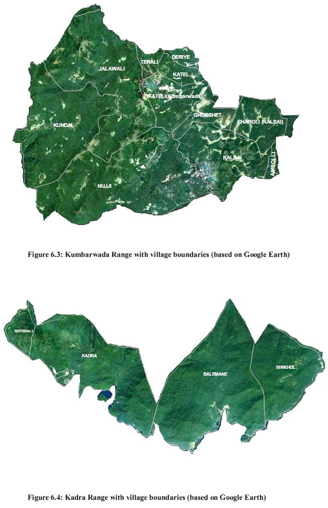
- Diggie range: Kalinadi originates from near a 900 m peak in Diggi Range. As the river has been dammed at Supa, towards the east of the Range is a vast water body, the Supa reservoir. This Range has good grassland areas with less of human population. These grasslands have to be properly managed by periodical use of fire as otherwise most them would revert back to forest with high rainfall and no fire. There should be no raising of monoculture plantations in these grassland areas.
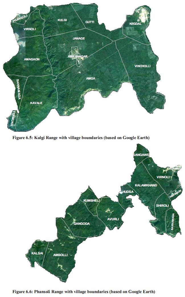
- Kumbarwada Range: Kumbarwada range has more hill top and slope grasslands (Figure 6.3). North western areas also have some larger flat grassland areas with meager human population. Some areas of Khushavali and Keloli beat are sparsely habituated and have more grassland plains. In the 19th century Kalsai and Amboli (a small part of the village in this Range) had fine deciduous forests as well as good evergreen forests as well. Shifting cultivation was widespread in this Range and therefore we can see fine grasslands, savannas and secondary forests. The region has good potential for wildlife.
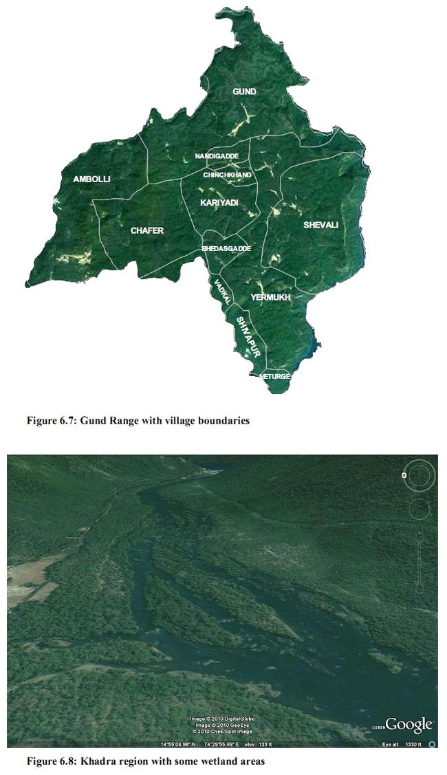
- Kadra Range: This is a very hilly forested area with very less of grasslands and other openings However the Kali River flowing by the side, and the Kadra reservoir add considerable habitat heterogeneity to the region. There are also steep barren hill slopes that enhance such heterogeniety. During the 19th century, the forest stretch along the Kalinadi had good deciduous forests mixed with natural teak. There were also good evergreen forest patches. Teak plantation was started here as early as 1859. The presence of deciduous forests here is evidence of past fires and shifting cultivation. Today the evergreen species are dominating this Range and grasslands are hardly present.
- Kulgi Range: This Range is also thickly forested with dry deciduous to moist deciduous forest mostly dominated by planted teak and monoculture plantations of teak (Figure 34). Hence it has very less of natural grasslands and the grasses occurring are forest grasses such as Oplismenus compositus or Oplismenus burmanii, along with Leptuca radicans which because of their low density, and less area can support very less wild life. To promote grass in this Range various kinds of openings including edges of water bodies, abandoned fields, forest clearance etc are to be preserved and managed without any further raising plantations inside them. Succession in forest plantations may be directed by promoting fruit and fodder trees natural to the region as well as through introduction of suitable species.
- Phansoli Range: Virnolli and eastern Phansoli areas are highly populated places. Being in lower rainfall zone the most of vegetation consists of deciduous forests and savanna woodlands. Avurli-Mandorli area, on the north side of the Kaneri river had excellent teak forests in the 19th century. The Kasai-Usode forest covering Kalsai, Ambodi, Gangoda, Potoli, Virnoli etc. had not much natural teak, but there were fine mixed deciduous forests. Kalsai had good patches of evergreen forests also. Wildlife-human conflicts seem to be more here because of the larger number of cattle kills. Such conflicts can be minimized by promoting better vegetation supportive of wildlife, including grasslands.
- Gund Range: The Gund-Shivapur forests, on the plateau of the river Kali in the south-east, was, in the 19th century well known for its forests- “great teak forests of Gund and splendid evergreen forests of Shivapur” (Campbell, 1883). The Range does not have many grasslands and other open areas suitable for ungulate wildlife. (Figure 6.7). The forests of the Range along with the water bodies provide good habitat heterogeneity for wildlife. Table 6.3 lists the grasslands visited during the field investigations.
| Table 6.3: Grassland study in Anshi and Dandeli W L Santuary |
| Sl. |
Transect location |
|
Lat |
long |
Alt |
| 1 |
Goyar-Savadi |
|
14.96731 |
74.28001 |
96 |
| 2 |
Kailwada-Dongrewada |
|
14.97914 |
74.39934 |
480 |
| 3 |
Kailwada - Kailwada |
|
14.98257 |
74.39884 |
466 |
| 4 |
Kailwada-Madgaon |
|
14.98644 |
74.39588 |
467 |
| 5 |
Thayamaddi-Barpoli Cross |
|
14.93885 |
74.3707 |
485 |
| 6 |
Burpalli-anshi |
|
14.94459 |
74.37508 |
494 |
| 7 |
Shiroli-near Bamnia |
|
15.21059 |
74.35571 |
589 |
| 8 |
Terali |
|
15.18345 |
74.36704 |
693 |
| 9 |
Kundal |
|
15.12269 |
74.31069 |
647 |
| 10 |
Kaneri damsite |
|
15.1141 |
74.3544 |
638 |
| 11 |
Virnoli safari route |
|
15.12485 |
74.59537 |
584 |
| 12 |
Shiroli mining area |
|
15.12153 |
74.60146 |
587 |
| 13 |
Mandurlli (Kulagi) |
|
15.16115 |
74.57316 |
578 |
| 14 |
Bommanahalli reservoir |
|
15.16617 |
74.67917 |
441 |
| 15 |
Lande |
|
15.04452 |
74.30956 |
652 |
| 16 |
Anshi |
|
15.01100 |
74.39397 |
633 |
|
|