ENVIS Technical Report: 89, July 2015 |
 |
Biodiversity, Ecology, Energy, Landscape Dynamics & Hydrology of Agastya Foundation Campus, Kuppam
| 
|
| Ramachandra T. V.* |
Harish R.Bhat |
Bharath H. Aithal |
Rao G. R. |
Sudarshan P.Bhat |
| Vinay S. |
Ganesh Hegde |
Gouri Kulkarni |
Vishnu D. Mukri |
|
|
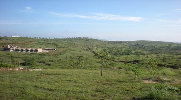
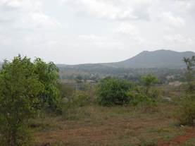
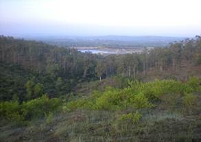
Agastya Fundation Campus is located between 12o48’30” to 12o49’41” N latitude and 78o14’56” 78o15’29”E longitude in the Deccan Plateau with an spatial extent of 70 hectares (~172 acres) at Gudivanka village, Kuppam of Andhra Pradesh. The campus borders three Indian States - Andhra Pradesh, Karnataka, and Tamil Nadu while sharing flora and fauna of these three regions. The campus comprises mainly scrub jungle, rocky outcrops interspersed with plains. The topography of the campus is undulating with a few hills and valleys. The area is rich in Deccan Plateau flora and fauna with many rare species.
Deccan Plateau, India
|
|
|
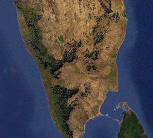
India with Deccan Plateau, Remote sensing data depicting landscape (http://earth.google.com) |
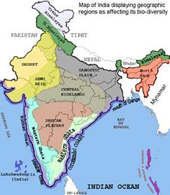
The Deccan Plateau is a large plateau in peninsular India, in the southern part of the country. It rises a hundred meters high in the north, and more than a kilometer high in the south, forming a raised triangle within the familiar downward-pointing triangle of the Indian subcontinent's coastline. It extends over central and southern India covering eight Indian states with a wide range of natural habitats.
It is located between three mountain ranges: the Western Ghats form its western boundary, and the Eastern Ghats its eastern boundary. Each rises from their respective nearby coastal plains and nearly meet at the southern tip of India.
Deccan plateau is separated from the Gangetic plain to the north by the Satpura and Vindhya Ranges, which form its northern boundary. The name Deccan is an anglicised form of the Prakrit word dakkhin, itself derived from the Sanskrit word dákṣiṇa, meaning "south". The climate of the region varies from semi-arid in the north to tropical in most of the region with distinct wet and dry seasons. Rain falls during the monsoon season from about June to October. March to June can be very dry and hot, with temperatures regularly exceeding 40°C.
The volcanic basalt beds of the Deccan were laid down in the massive Deccan Traps eruption, which occurred towards the end of the Cretaceous period between 67 and 65 million years ago. Some paleontologists speculate that this eruption may have accelerated the extinction of the dinosaurs. Layer after layer was formed by the volcanic activity that lasted many thousands of years, and when the volcanoes became extinct, they left a region of highlands with typically vast stretches of flat areas on top like a table. The volcanic hotspot that produced the Deccan traps is hypothesized to lie under the present day island of Reunion in the Indian Ocean. |
|
|
|
Agstya Foundation campus with diverse picturesque landscape elements |
Number of flowering plants in the globe |
~2,58,650 |
Number of flowering plants in India |
~ 17,500 |
Agasthya Campus at Kuppam |
~ 600 |
| |