Threats |
- Encroachment of lake bed and buffer zone (75 m is buffer and is to be without any construction activities).
- Loss of interconnectivity among drains – due to encroachments or dumping of soil, etc.
- Silt accumulation in the water body – de-silting should have been done at least once in three years
- Removal of macrophytes in the buffer zone (these macrophytes were helping in bioremediation)
- Unplanned urbanisation in the catchment would be detrimental to the sustenance of water in the lake.
|
Solutions |
- Re-establish interconnectivity among lakes (Figure 6.6) by removal of all drain encroachments and blockages.
- De-silting of lakes.
- Maintaining green cover (grasses and trees – native species) at least 30-40% of the catchment area.
- Encouraging farmers to adopt agro forestry of native species
- Phasing out exotic water demanding species such as Eucalyptus, etc.
- Aquatic emergent macrophytes in the buffer zone of the lake (Figure 6.7).
- Appropriate soil and water conservation (drip or sprinklers to minimize water use) measures.
|
Kandavar Lake located in Chikkaballapur is one of the main water source for Chikkaballapur City. Lake (Figure 6.1) is spread across 4 villages (Figure 6.2 to Figure 6.5) of Chikkaballapur taluk namely Kandavara, Ammanikere-Kandavara, Mallappanahalli and Ganganamidde encompassing an area of ~ 1.68 sq.km. Majority of lake is covered in Kandavara Ammanikere Village. The lake has a catchment area of 35.25 sq.km.(Figure 6.6). Figure 6.7 depicts the Lake with buffer zone of 75 meters and Figure 6.8 depicts encroachment in the lake. Current encroachment of 7.89 hectares. Rainfall in the catchment is about 880 mm (Figure 6.9). Land use in the catchment is dominated by agriculture (Figure 6.6). With existing rainfall, annual yield of 13750 Million liters (0.48 TMC) can be expected in the catchment.
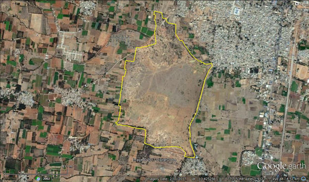
Figure 6.1: Kandavara Lake
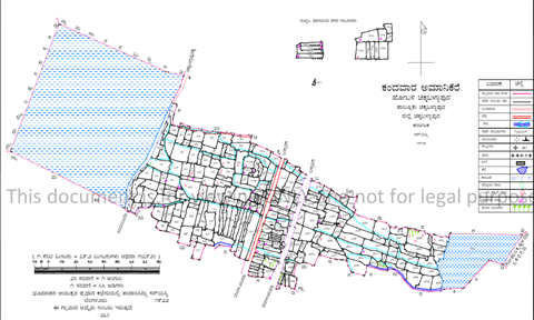
Figure 6.2: Kandavara Ammanikere Village
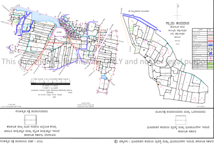
Figure 6.3: Kandavara Village
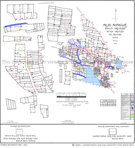
Figure 6.4: Ganganamidde Village
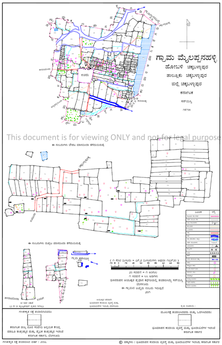
Figure 6.5: Mallappanahalli Village
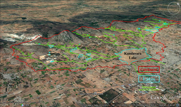
Figure 6.6: Kandavara lake, catchment and its drains as on Google Earth.
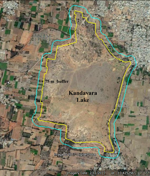
Figure 6.7: Kandavara Lake and Buffer distance of 75 meters
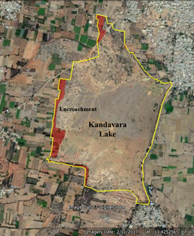
Figure 6.8: Lake Encroachment
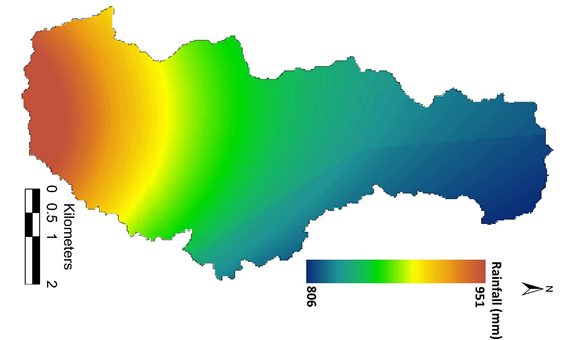
Figure 6.9: Rainfall distribution
Recommendations
- Decentralized rain water harvesting through lakes, recharge pits, etc.;
- Constructed wetlands integration with lakes to prevent water contamination (with agriculture run off, sewage inflow, etc.);
- Catchment/watershed management for effective soil and water conservation;
- Rejuvenation of existing lakes
- De-silting to enhance the storage capacity as well as groundwater recharge;
- Reestablish inter-connectivity among lakes;
- Removal of all encroachments (lake bed, natural drains);
- Maintaining at least 33% green cover (of native species) in the catchment;
- catchment treatment (through planting native saplings)
- Incentive to create farm ponds in all agricultural fields (this helps in ground water recharge, and also helps in fish rearing and hence local livelihood)
- Restrictions on any construction activity in the buffer zone of a lake (75 m).
- Maintaining aquatic macrophytes in the buffer zone of each lake, which helps in bioremediation.
- Phasing out monoculture plantations of exotic species (such as eucalyptus, etc. which sucks groundwater) with native species on priority.
- Appropriate cropping pattern and restriction on crops that are water intensive.
- Allowing only dry land crops;
- Incentives to farmers growing crops suitable for semi arid region;
- Greening/afforestation in the catchments of water bodies (lakes, rivers, etc.) with native species, ensure that at least 33% is maintained with native trees and grasses to enhance water retaining capacity of Catchment/watershed;
- Inclusions of concepts - watershed, environment, afforestation, reforestation in the education curriculum (Schools and Colleges);
- Management of water bodies involving all stakeholders, and constitution of joint environment management committee at each village level to address the issue of forest as well as water bodies;
- Restriction on sand mining beyond sustainable yield;
- Restrictions on bore wells and regulation of number of wells in a region (to mitigate overexploitation)
- Kolar has distinction of having highest barren area (un-productive land) and is heralding towards desertification (next to Rajasthan). This requires immediate afforestation in the catchment through CAMPA. Auditing of these activities through independent and unbiased academic institutions.
- Environment education / awareness programmes to sensitize farmers, youth and school children.
|
T.V. Ramachandra
Centre for Sustainable Technologies, Centre for infrastructure, Sustainable Transportation and Urban Planning (CiSTUP), Energy & Wetlands Research Group, Centre for Ecological Sciences, Indian Institute of Science, Bangalore – 560 012, INDIA.
E-mail : tvr@iisc.ac.in
Tel: 91-080-22933099/23600985,
Fax: 91-080-23601428/23600085
Web: http://ces.iisc.ac.in/energy
Vinay SEnergy & Wetlands Research Group, Centre for Ecological Sciences, Indian Institute of Science, Bangalore – 560 012, INDIA.
E-mail: svinay@iisc.ac.in
Bhargavi R
Energy & Wetlands Research Group, Centre for Ecological Sciences, Indian Institute of Science, Bangalore – 560 012, INDIA.
E-mail: bhargavis@iisc.ac.in
Bharath H AithalEnergy & Wetlands Research Group, Centre for Ecological Sciences, Indian Institute of Science, Bangalore – 560 012, INDIA.
E-mail: bharathh@iisc.ac.in
Citation: Ramachandra T V, Vinay S, Bhargavi R and Bharath H. Aithal 2017. Integrated Watershed Management for Water and Food Security in Kolar and Chikballapur districts, Karnataka, ENVIS Technical Report 133, Energy & Wetlands Research Group, CES, Indian Institute of Science, Bangalore 560012
| Contact Address : |
| |
Dr. T.V. Ramachandra
Energy & Wetlands Research Group,
Centre for Ecological Sciences,
New Biological Sciences Building, 3rd Floor, E-Wing, Lab: TE15
Indian Institute of Science, Bangalore – 560 012, INDIA.
Tel : 91-80-22933099 / 22933503(Ext:107) / 23600985
Fax : 91-80-23601428 / 23600085 / 23600683 [CES-TVR]
E-mail : tvr@iisc.ac.in, energy@ces.iisc.ac.in,
Web : http://wgbis.ces.iisc.ac.in/energy |
|