|
||||
|
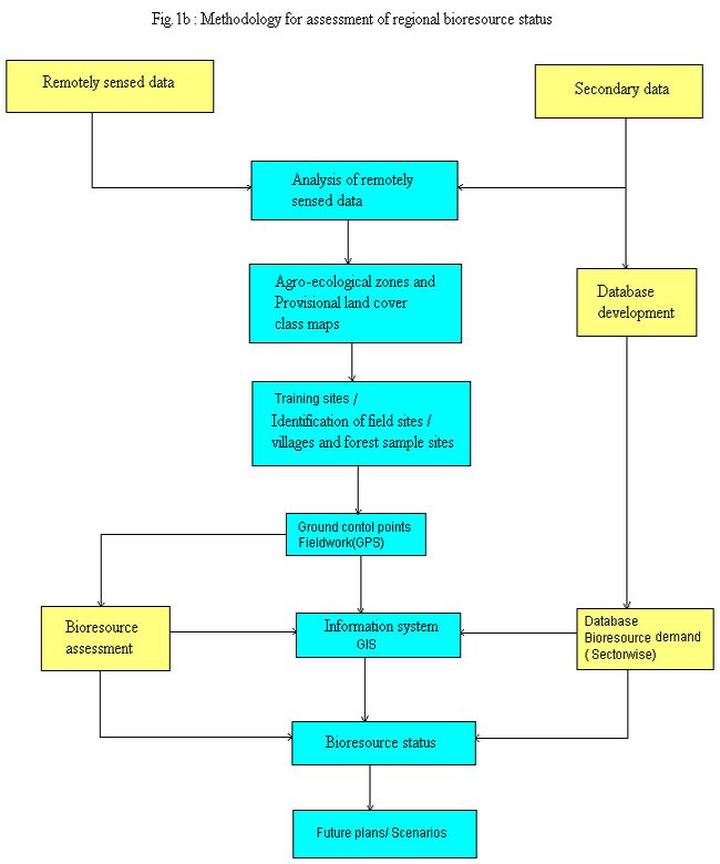
Methodology : An integrated approach involving compilation of data from government agencies and institutions, application of spatial and temporal analyses using remote sensing data, Geographic Information System (GIS technique) and conventional field survey (ground truthing) have been adopted in this study (Fig 1b). The vegetation map for Kolar district (talukwise) were prepared based on the interpretation of IRS-1C satellite imageries, using the visual interpretation keys such as tone, colour, texture, pattern, association, size, shape, topography and drainage. This involves Data acquisition, loading, composite generation and georeferencing Georeferencing has been done by extracting GCPS from topographical map and using GPS. Multispectral classifications was carried out using soft classifiers (based on Bayesian probability theory).
|
||||