|
Comprehension of temporal land use dynamics in urbanising landscape
|
 |
1Energy & Wetlands Research Group, Centre for Ecological Sciences [CES], 2Centre for Sustainable Technologies (astra), 3Centre for infrastructure, Sustainable Transportation and Urban Planning [CiSTUP],
Indian Institute of Science, Bangalore – 560012, India.
*Corresponding author: cestvr@ces.iisc.ac.in
|
STUDY AREA
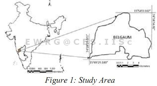
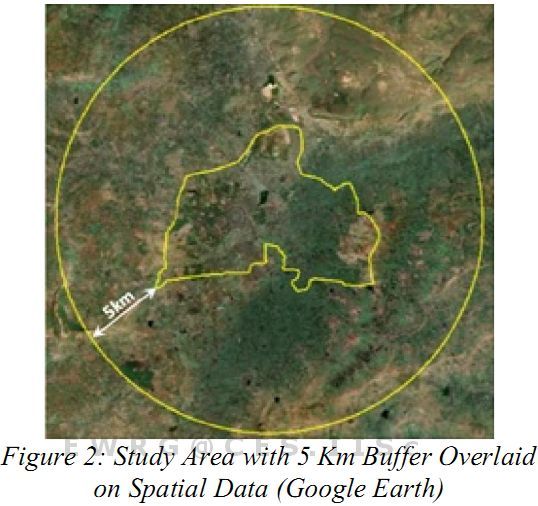
Belgaum City (Figure 1) geographically located in the north western part of Karnataka state. The city extends from 74o28’29.071” to 74o34’54.92” E and 15o49’23.189” to 15o54’0.142” N with an average elevation of 751m above mean sea level and spatial extent of 5798 hectares. For the study a 5km buffer from the administrative boundary was considered as shown in Figure 2, with a gross area of 38013.27 hectares, to account for the growth in peri urban regions. The city has about 58 wards, with population of 488292 (2011 Census provisional) and population density of 84.21 persons per hectare, the population in the region has a decadal increase of 7.31%. Temperature varies from as low as 18 oC (winter) to 40 oC (summer) and annual average rainfall is about 1418 mm. Soils in the region consist of shallow to very deep black soils, red loamy soils, lateritic soils, etc. The city is surrounded by Kanburgi, Yamanspura, Kangrali.B, Kangrali.K villages to the north, Hindalga, Binakanahalli, Savagaon, Madoli to the West, Angol, Wadgaon, Madhavapura, Haldge to the South and Sindoli, Mutuge, Nilage Villages to the East.
Figure 1: Study Area
Figure 2 demarcates the study area (Google earth) with 5 km buffer along the city administrative boundary
Figure 2: Study Area with 5 Km Buffer Overlaid on Spatial Data (Google Earth)
|
|
Citation : Ramachandra. T.V., Bharath H. Aithal and Vinay S., 2013, Comprehension of temporal land use dynamics in urbanising landscape., Proceedings of National Remote Sensing Centre, ISRO, Balanagar, Hyderabad., User Interaction Meet - 2013, 21-22, February, 2013., pp. 1-6.
|