|
Lotic Ecosystems of Central Western Ghats: Overview
Rivers of the central Western Ghats are unique in their geomorphology, due to the presence of ‘river capture’ in most of the rivers. When the Indian plate moved away from the Gondwana land, peninsular portion experienced an eastward tilt, which changed the pattern of drainage in many rivers. In many cases, like the river Sharavathi and Kali in Uttara Kannada (figure 1), the western faulting led to 'river capture' and diversion of the easterly drainage to the west (Radhakrishna, 1991). There are abrupt drops as water falls such as Jog Falls, Unchalli, Magod through gorges and cascades of rivers flow along the upper reaches of the Western Ghats.
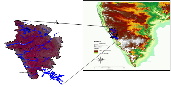
Figure 1 depicts the four major rivers in the central Western Ghats. These rivers are Kali, Bedthi, Aghanashini, Sharavathi and Venkatapura.
Kali River: Kali (Figure 2) extends to a length of 184 km, earlier originated near the village Diggi in Supataluk, as Karihole. After the construction of the dam near Supa, the entire region is now submerged in the reservoir. Pandri and Ujli are the two main feeders to this river in the North and the stream Tattihalla also joins near Haliyal. The Kaneri and the Vaki are its two main tributaries joins later at Dandeli and Anshi Tiger Reserve. Later near Kadra, Thananala joins the main river. In all, the catchment area of the river is about 5,179 sq. km and the annual river discharge is 6,537 million cu. M (Bhat, 2002). There are four major dam projects on this river - the Supa reservoir near the headwaters, the Bommanhalli reservoir near the Dandeli Wildlife Sanctuary, the Kodasalli dam near Ganeshgudi and finally, one at Kadra (which is the part of the Kaiga project).
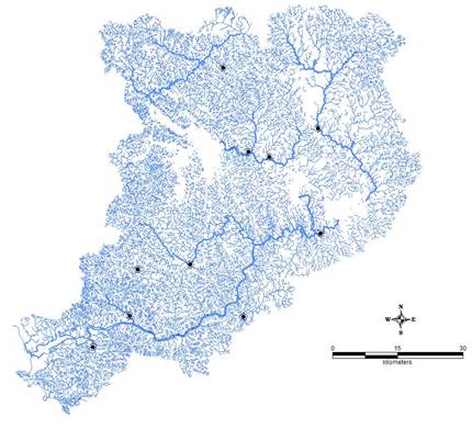
Figure 2: River Kali with sampling sites
Bedthi River: River Bedthi (Figure 3) is a result of the confluence of two major streams, and the Bedthi stream, which originates near Hubli taluk. They join near Kalghatgi and the river flows for about 25 km westwards and enters the district of Uttara Kannada. After a southwesterly course of about 32 km, it falls into the sea. The united river extends about 8km south east to the border of Uttara Kannada and flows in the district for a length of 96km. The river, which extends to 152 km with a. catchment area of 3902 sq. km and discharges 4,925 million cu. m of water annually.
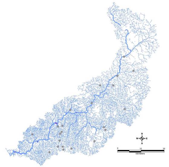
Figure 3: River Bedthi with sampling sites
Aghanashini River: Aghanashini river (Figure 4) arises at Manjguni near Sirsi. After a winding westerly course of about 70 km, it falls off into the sea about 10km south of Bedthi. The river has two sources - a tributary called Bakurhole, rising at Manjguni, about 25km west of Sirsi and Donihalla, which is close to Sirsi. The two streams meet at Mutthalli about 16 km south of Sirsi. Under the name Donihalla, it flows about 25 km south of Sirsi westwards to Sahyadri’s west face and at Heggarne in Siddapur, it falls off a height of about 116 m as the Lushington (or the Unchalli) falls. Further down 6 km from Bilgi near Hemanbail, it flows down again as the Burdejog. It finally meets the tide at Uppinpatna. The Aghanashini covers a catchment area of 2,146 sq. km, with an annual discharge of 966 million cu. m.
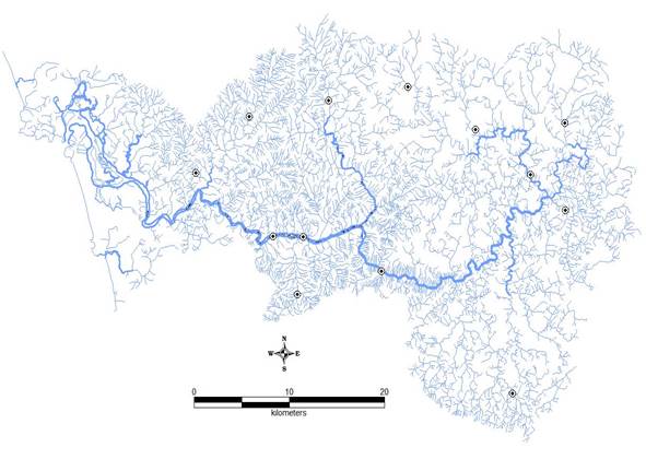
Figure 4: River Aghanashini with sampling sites
Sharavathi River: Sharavathi river (Figure 5) originates at Ambutirtha in Tirthahallitaluk of Shimoga district. After a northerly course of about 64 km from Sagar, it forms the southeastern border of the Uttara Kannada district for about 13km and flows a further 32 km west in all, it flows 128 km to join the sea at Honnavar. Soon after touching the Uttara Kannada border the river falls off the western face of the Ghats in Jog falls at a height of 252 m into a pool 117 m deep. About 30km west, it reaches Gersoppa. The Sharavathi extends to a length of 122 km, with a catchment area of 2,209 sq. km and an annual discharge of 4,545 million cu.m.
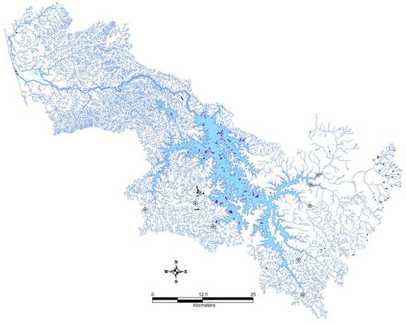
Figure 5: River Sharavathi with sampling sites
Venkatapura River: Venkatapura river (Figure 6) is located between 13.98° - 14.15° N and 74.48°- 74.73° E in the southern part of Uttara Kannada district of Karnataka, India (Figure 1). It originates in Western Ghats and confluence into Arabian Sea after a course of 45 km near Venkatapura with a catchment of 335 km2. Forest and agriculture are the major land use in the catchment. The river basin is divided in to six sub basins namely Venkatapura tributary, Chitihalla, KatagarNala, BastiHalla, Kitrehole and Venkatapura River based on major tributaries.
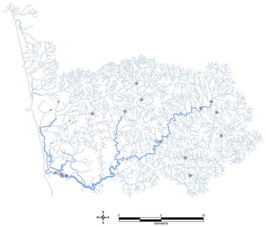
Figure 6: Venkatapura River with sampling sites
|

