
Materials and methods
Study area
Uttara Kannada with the spatial extent of 10,291 km2 is located at 74°9′-75°10′ E and 13°55′-15°31′ N in the mid-western part of Karnataka state, India (Figure 1). The regions with undulating hills, rising steeply from a narrow coastal strip bordering the Arabian Sea to a plateau at an altitude of 500 m, with occasional hills rising above 600 to 860 m lies in the central part of Western Ghats (Ramachandra and Subramanian, 1997a, P: 947). Figure 2 illustrates the topographic undulations of the region. Topographically, the district lies in three distinct zones namely narrow and flat coastal zone, abruptly rising ridge zone and elevated flatter eastern zone. The coastal zone is thickly populated with coconut clad villages. Ridge zone is a part of the main range of Western Ghats, which runs north to south, parallel to the coast. The flat eastern zone joins the Deccan plateau. The taluks, which comprises the narrow flat coastal zone, are: Karwar, Ankola, Kumta, Honnavar and Bhatkal. Similarly, taluks, which comprises the ridge zone, are: Supa, Haliyal, Yellapur, western Sirsi, and western Siddapur. Flatter eastern zone includes Mundgod, eastern Sirsi and eastern Siddapur. Four agro-climatic zones based on geography and climate are coastal, evergreen, dry deciduous and moist deciduous. There are 1291 villages, 7 towns, 5 city municipal corporations/town municipal corporations/outward growth/census towns and 2 reservoirs in the district [http://uttarakannada.nic.in/].
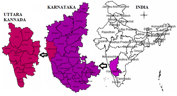 |
Figure 1: Location of Uttara Kannada |
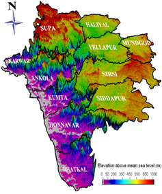 |
Figure 2: Digital Elevation Model of Uttara Kannada, Karnataka |