 |
Random Forest Algorithm with derived Geographical Layers for Improved Classification of Remote Sensing Data
|
 |
1Energy and Wetlands Research Group, Centre for Ecological Sciences [CES], 2Department of Management Studies, 3Centre for Sustainable Technologies (astra),
4Centre for infrastructure, Sustainable Transportation and Urban Planning [CiSTUP],
Indian Institute of Science, Bangalore – 560012, India.
*Corresponding author: cestvr@ces.iisc.ac.in
|
DATA AND STUDY AREA
Data
Survey of India (SOI) Topographical Sheets (of 1:50000 and 1:250000 scales) were used to generate base layers. Field data were collected with pre-calibrated handheld GPS. Landsat ETM+ data were downloaded from Global Land Cover Facility (http://www.landcover.org) and SRTM elevation data were downloaded from http://glcf.umiacs.umd.edu/data/. Google Earth images (http://Earth.google.com) were used with the field data for validating classified outputs. Ancillary layers such as elevation and its derived layers such as slope and aspect along with NDVI, EVI and textures (ASM - angular second moment, contrast, entropy and variance) were used in separate experiments during classification.
Study area
Three different terrains were selected to test the performance of the classification strategy as briefed below:
- A part of the Greater Bangalore City (Fig. 1) which is a highly urbanised area, comprising dense builtup, parks, roads, streets, flyovers, walk ways, open land, etc. Dense and medium urban areas have high surrounding temperatures compared to vegetation patches, parks and lakes [1]. The undulating terrain in the city ranges from 735 to 970 m with varying textures due to different urban structures.
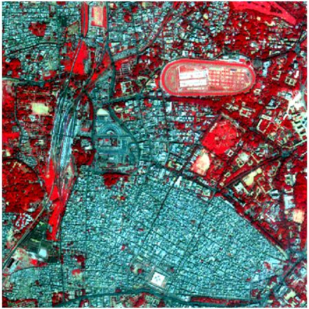 Figure 1:
 False Colour Composite of the Landsat ETM+ data of a part of Greater Bangalore. - A part of Central Western Ghats with gentle undulating hills, rising steeply from a narrow coastal strip bordering the Arabian sea to a plateau at an altitude of 500 m with occasional hills rising above 600 to 860 m (Fig. 2).
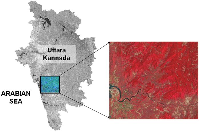 Figure 2:
 Location of the study area in Central Western Ghats - A part of Western Himalaya having temperate climate and rugged terrain with altitude ranging from 295 to 6619 m above mean sea level (Fig. 3).
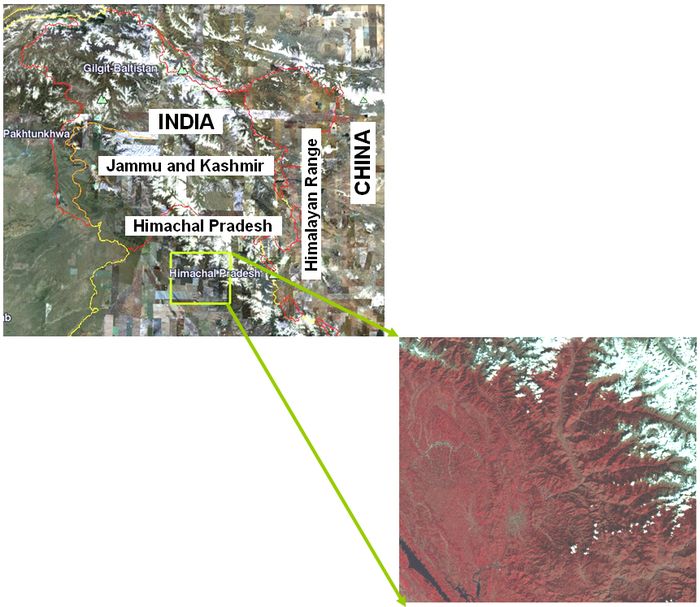 Figure 3:
 Location of the study area from a part of Western Himalaya
|
|
Citation : Uttam Kumar, Anindita Dasgupta, Chiranjit Mukhopadhyay and Ramachandra. T.V., 2011, Random Forest Algorithm with derived Geographical Layers for Improved Classification of Remote Sensing Data., Proceedings of the INDICON 2011, Engineering Sustainable Solutions, 16-18th December, Hyderabad - India, pp. 1-6.
|