
Karnataka is one of the largest states of South India. The state covers an area of 191,976 square kilometres or 5.83% of the total geographical area of India. It is the eighth largest Indian state by area, the ninth largest by population and comprises 30 districts. According to Population census of 2011, the Population of Karnataka is 61.09 million which 52.73 million in 2001. The Population of Karnataka has increased by 15.6% in 2011 from 2001 and comparatively increased by 17.20% in 2001 as compared to census of India in 1991. Karnataka lies between the Latitudes : 14o 49' 37.15"N to 13o 18' 39.29"N, Longitude:76o 56' 37.1"E to 77o 28' 15.66"E The study area considered are Tier two cities of Karnataka which have a population of 2 lakhs - 8 lakhs, namely Mysore, Shimoga, Hubli- Dharwad, Belgaum, Bellary, Raichur, Gulbarga (Figure 1).
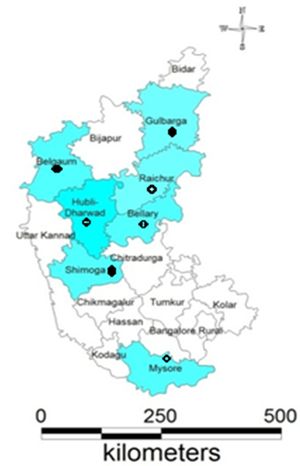
Figure 1: Study Area - Tier II Cities in Karnataka