|
STUDY AREA
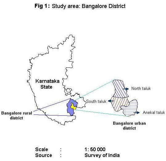
Bangalore district is located in the southern part of Karnataka state (Figure 1), stretched between latitudes 12° 39' - 13° 18' N and 77° 22' - 77° 52' E longitudes covering an area of about 2,191 sq. km. and supporting about 27.41 %, (5 million) of the total urban population [Census, 1991] of the state. The district has a mean maximum temperature of 36.2°C in April and a mean minimum temperature of 11.4°C in January and an average rainfall of 860 mm. This district is divided into rural and urban, with Bangalore urban consisting of North, South and Anekal taluks. The Bangalore City area is spread between Bangalore North and South taluks (at the center) covering an area of about 151 sq. km. at an average elevation of 900m. The current study is carried out in Bangalore city limits [as defined by Bangalore City Corporation (BCC) in Bangalore urban district].
Bangalore rural is located between Latitudes 12° 15' to 13° 35' N and 77° 05' to 78° E longitudes at an elevation ranging between 600-900 above MSL and spanning an area of 5814 sq. km. The district with head quarters at Bangalore, consists of eight taluks, namely, Channapatana, Ramanagaram, Kanakapura, Dodaballapur, Hoskote, Magadi, Devanahalli and Nelamangala. |