Study area
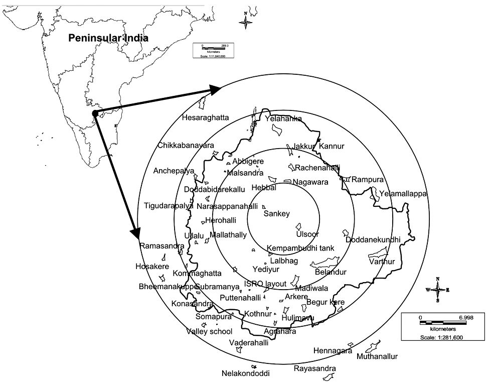
Bangalore with a current population of 9.5 million is located at 12o 39' to 13o 18' N and 77o 22' to 77o 52' E at an average elevation of 900m above sea level (Fig. 1). It represents a semi-arid to arid region with soil type varying from red loamy to laterite and physiography ranges from rocky upland, plateau to flat–topped hills that form a slope at south and south east along with Pediplains along western parts (http://cgwb.gov.in). Bangalore’s topography had allowed the creation of a large number of inter-connected water bodies during the 16th century at the time of Kempe Gowda and the Wodeyar dynasty making provision for the traditional uses of irrigation, drinking, fishing and washing. Four valleys, viz. Hebbal, Koramangala, Challaghatta and Vrishabhavathi, of the Bangalore metropolitan region drained the rainwaters through interconnected wetlands. Recent studies reveal that there has been a 632% increase in built-up area with 78% loss of vegetation cover and 79% loss of wetlands in Bangalore (Ramachandra & Kumar 2008). Studies based on spatial metrics indicate the radial pattern of urbanisation in Bangalore i.e., urban patches are clumped at city center but are more fragmented towards the periphery with very few clustered urban patches (Ramachandra et al. 2012). In the past 10 years, numerous wetlands at urban pockets were degraded due to the sustained inflow of untreated or partially treated waste water from densely populated, domestic and industrial localities. However, wetlands situated at city margin/peripheral regions in less populated are exposed to less anthropogenic activities (Sudhira et al. 2007) and maintain pristine status.
Fig. 1. Distribution of 43 sampled wetlands in Bangalore.


