 |
QIP Short Term Course On “Free & Open Source Geospatial Technologies (FOSS4G) FOR NATURAL RESOURCES MANAGEMENT”
9th - 13th APRIL 2018
|
|
|
|
QIP Short Term Course On “Free & Open Source Geospatial Technologies (FOSS4G) FOR NATURAL RESOURCES MANAGEMENT”
9th - 13th APRIL 2018
|
|
|
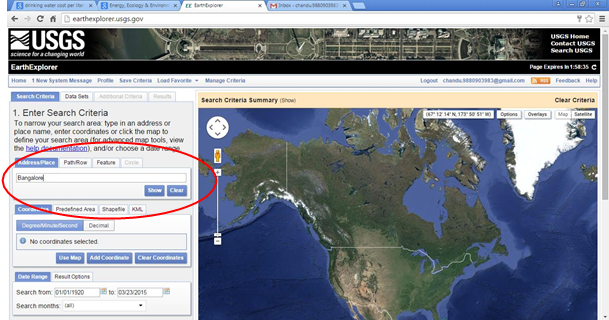
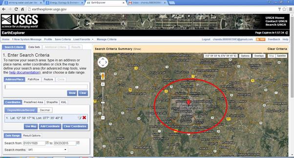
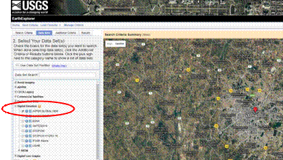
STEPS TO OBTAIN 30M RESOLUTION SATELLITE DATA SETS FOR PARTICULAR AREA OF INTEREST. 1. Visit USGS earth explorer Website: http://earthexplorer.usgs.gov/
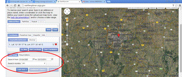
5. After entering place name, select Date range. For ex. 01.01.2000 to
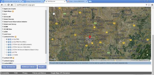
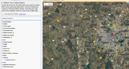
6. Now click on datasets and choose Landsat Archive in the “SELECT YOUR DATA SET” tab
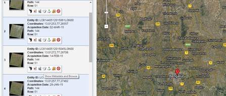
8. Select the tab Show metadata and browse.
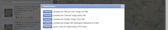
10.Now click on Download options tab and select Level 1 GeoTIFF Data
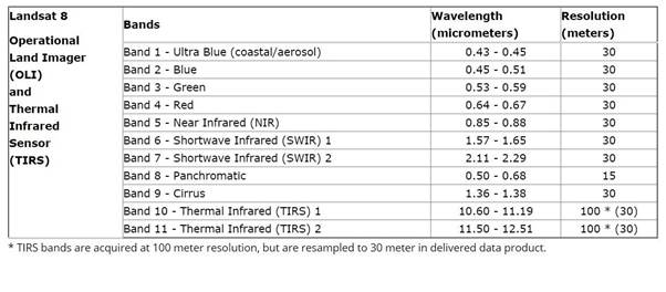
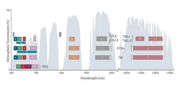
DONE!!! YOUR DATA WILL BE DOWNLOADED IN FEW MINS. Annex1: Landsat 8 bands
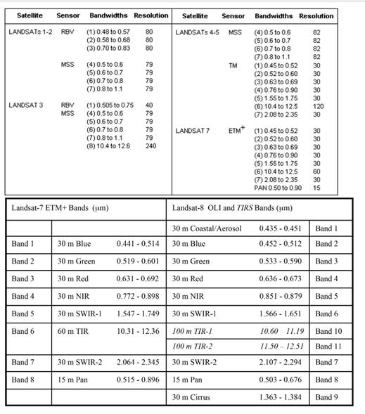
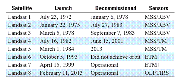
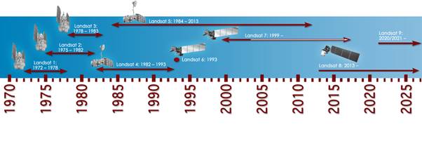
Annex2: Landsat series - sensors
USGS-Satellite data download steps
Annex4: The Multispectral Scanner System (MSS) aboard Landsats 1–5 had four bands. The Thematic Mapper (TM) aboard Landsats 4 & 5 had seven bands. Landsat
----
Similarly for Sentinel data, choose Sentinel-2 under Sentinel tab.
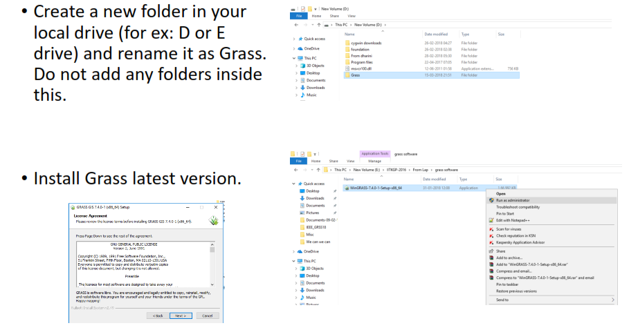
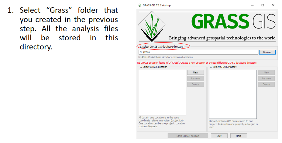
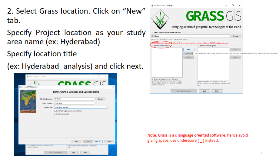
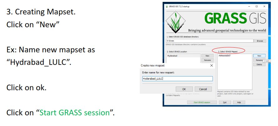
Introduction to Grass GISCreate a new folder in your local drive (for ex: D or E drive) and rename it as Grass. Do not add any folders inside this.
|
AICTE, NEW DELHI |