
 Sahyadri ENews Issues: I - LXXVIII

Centenary Pond at Indian Institute of Science - Optimal Rain Water Harvesting at Decentralised levelCite
Ramachandra T V
ENVIS[RP], Environmental Information System, Energy and Wetlands
Research Group,
Centre for Ecological Sciences, Indian Institute of Science -
560012
envis.ces@iisc.ac.in
tvr@iisc.ac.in Phone:
080 22933099/22933503
REFERENCES:
World Urbanization Prospects. (2005). Revision, Population Division, Department of Economic and Social Affaris, UN.
Ramachandra T V and Uttam Kumar (2009). Land surface temperature with land cover dynamics: multi-resolution,spatio-temporal data analysis of Greater Bangalore, International Journal of Geoinformatics, 5 (3):43-53
Ramachandra T.V and Uttam Kumar (2008). Wetlands of Greater Bangalore, India: Automatic Delineation through Pattern Classifiers, The Greendisk Environmental Journal. Issue 26 (International Electronic Jour. URL: (http://egj.lib.uidaho.edu/index.php/egj/article/view/3171).
Ramachandra T.V. and Shwetmala (2009). Emissions from India's Transport sector: Statewise Synthesis, Atmospheric Environment, 43 (2009) 5510-5517.
Sudhira, H.S., Ramachandra, T.V., and Jagadish, K. S. (2003). Urban sprawl: metrics, dynamics and modelling using GIS, International Journal of Applied Earth Observation and Geoinformation 5(2004): 29-39.
Kulkarni, V. and Ramachandra T.V. (2006). Environmental Management, Commonwealth Of Learning, Canada and Indian Institute of Science, Bangalore.
Deepa R. S., Kiran R., Ramachandra, T. V., (1997) Application of Geographical Information Systems (GIS) and Remote Sensing in the study of the spatial and temporal changes in the water bodies of Bangalore, Karnataka, Twelfth Annual Conference of National Environmental Science Academy (NESA), New Delhi.
INTERGRAPH, URL: http://imgs.intergraph.com/geomedia/
Muthreja, K. N., (1995) Applied Hydrology, Tata McGraw-Hill Company Limited, New Delhi.
Radhkrishnan, K., Adiga, S., Geeta Varadan, Diwakar, P.G., (1996) Enhanced geographic information system application using IRS-1C data - Potential for urban utility mapping and modelling, Current science, 70(7), pp. 629-637.
Raghunath, H. M., (1985) Hydrology, Wiley Eastern Limited, New Delhi.
Ramachandra, T. V. and Uttam Kumar, (2004). Watershed management using GRDSS, GIS Development, 8 (8):20-26.
Rolta India Limited Geomedia Professional 5.1, URL: http://www.rolta.com
Table 1: Catchment coefficient for various land uses.
Catchment Type with rainfall and runoff |
Run off co-efficient |
Dry tracts with annual rainfall 350 to 750 mm, run off 15 to 20 % |
0.15 to 0.2 |
Intermediate Zones rain 750 to 1500 mm, run off 20 to 30 % |
0.2 to 0.3 |
Higher Zone with rainfall above 1500 mm, run off 30 to 55 % |
0.3 to 0.55 |
Roof and paved areas, run off 80 to 90 % |
0.8 to 0.9 |
Table 2: Volume computation for various depths
Area 1 ha |
Area 1.5 ha |
||
Capacity (m3) |
Depth (m) |
Capacity (m3) |
Depth (m) |
5000 |
0.5 |
7500 |
0.5 |
10000 |
1 |
15000 |
1 |
15000 |
1.5 |
22500 |
1.5 |
20000 |
2 |
30000 |
2 |
25000 |
2.5 |
37500 |
2.5 |
30000 |
3 |
45000 |
3 |
35000 |
3.5 |
52500 |
3.5 |
40000 |
4 |
60000 |
4 |
Figure 1: Map of IISc campus with important landmarks.
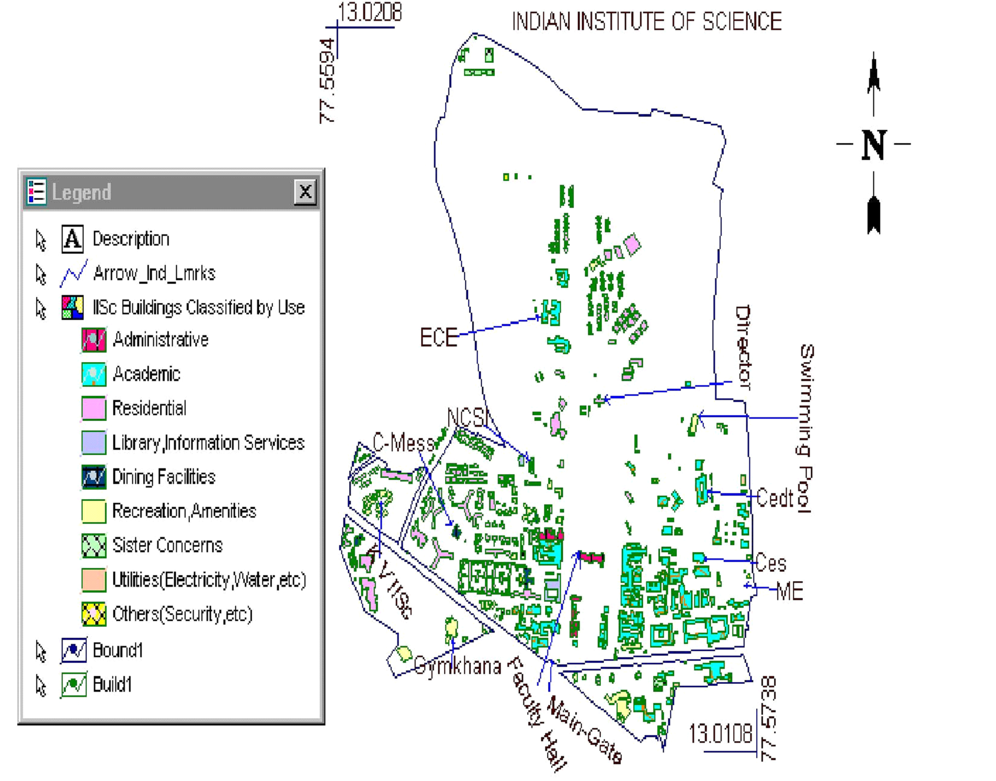
Figure 2: Tree distribution in IISc campus.
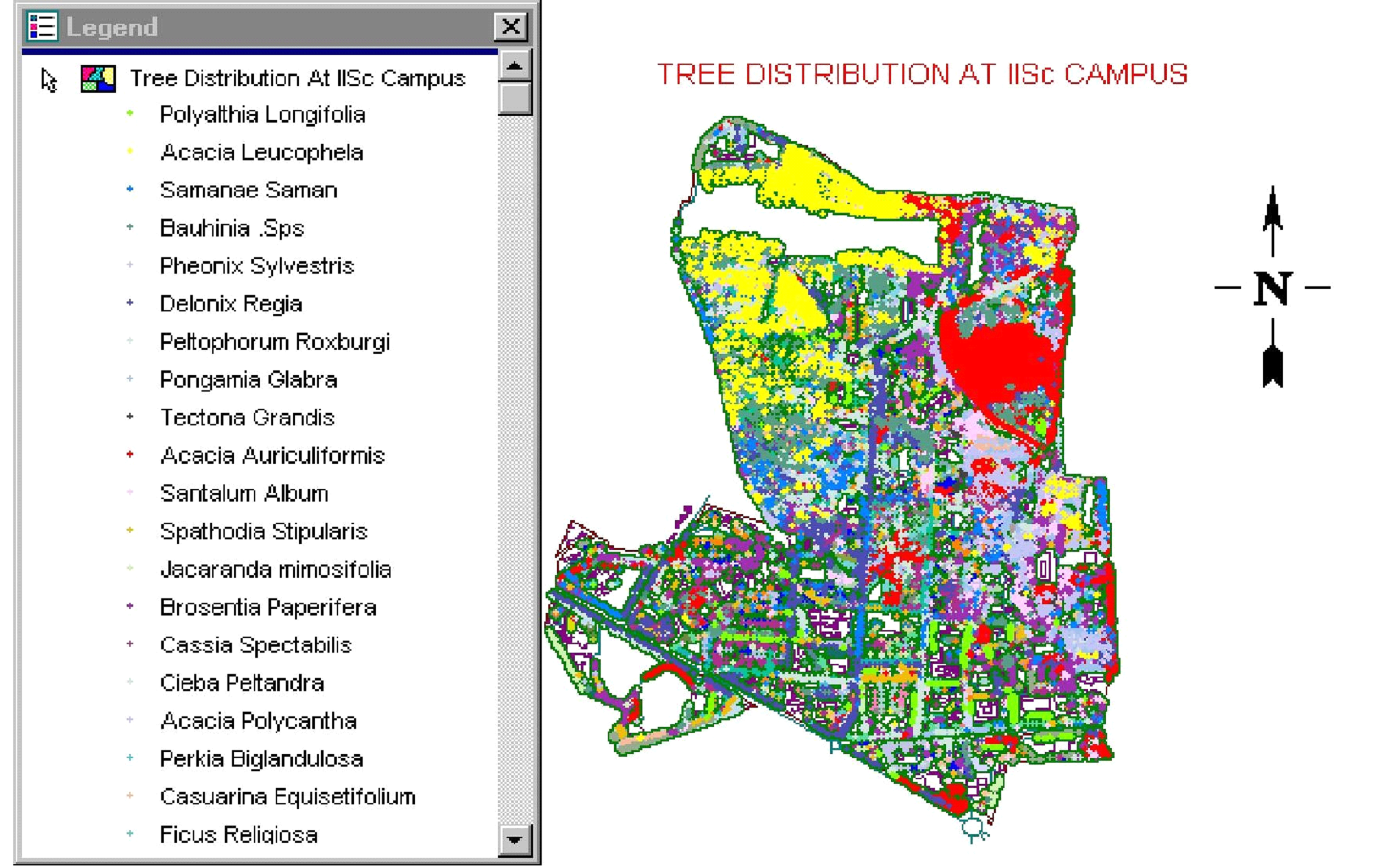
Figure 3: IISc campus bounded by the existing lakes.
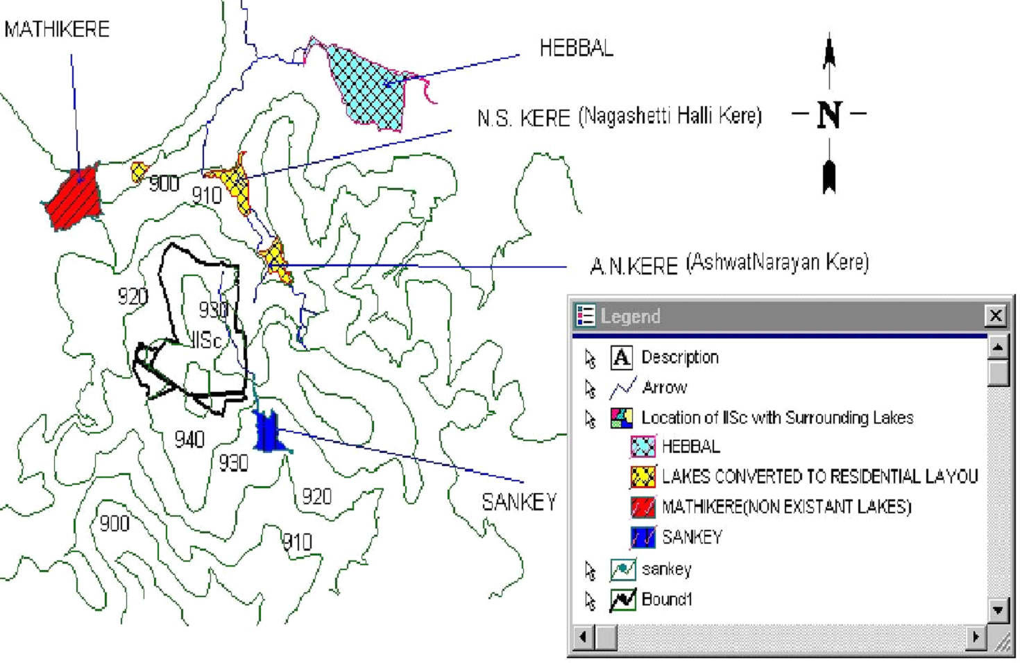
Figure 4: Digital Elevation Model of the IISc campus.
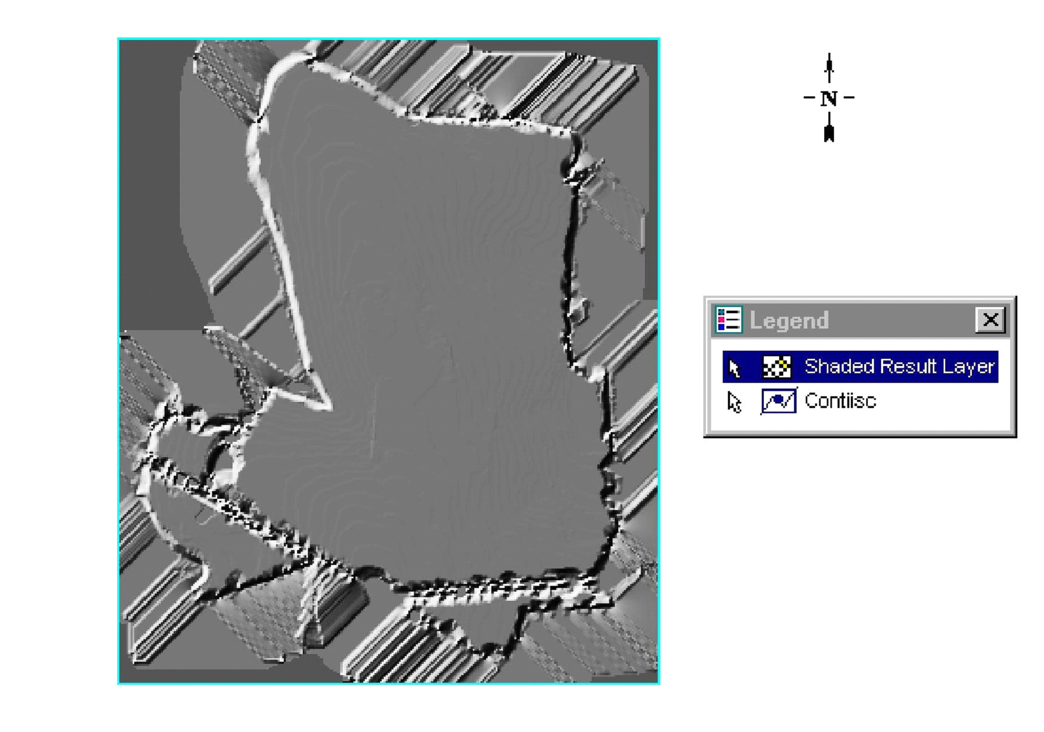
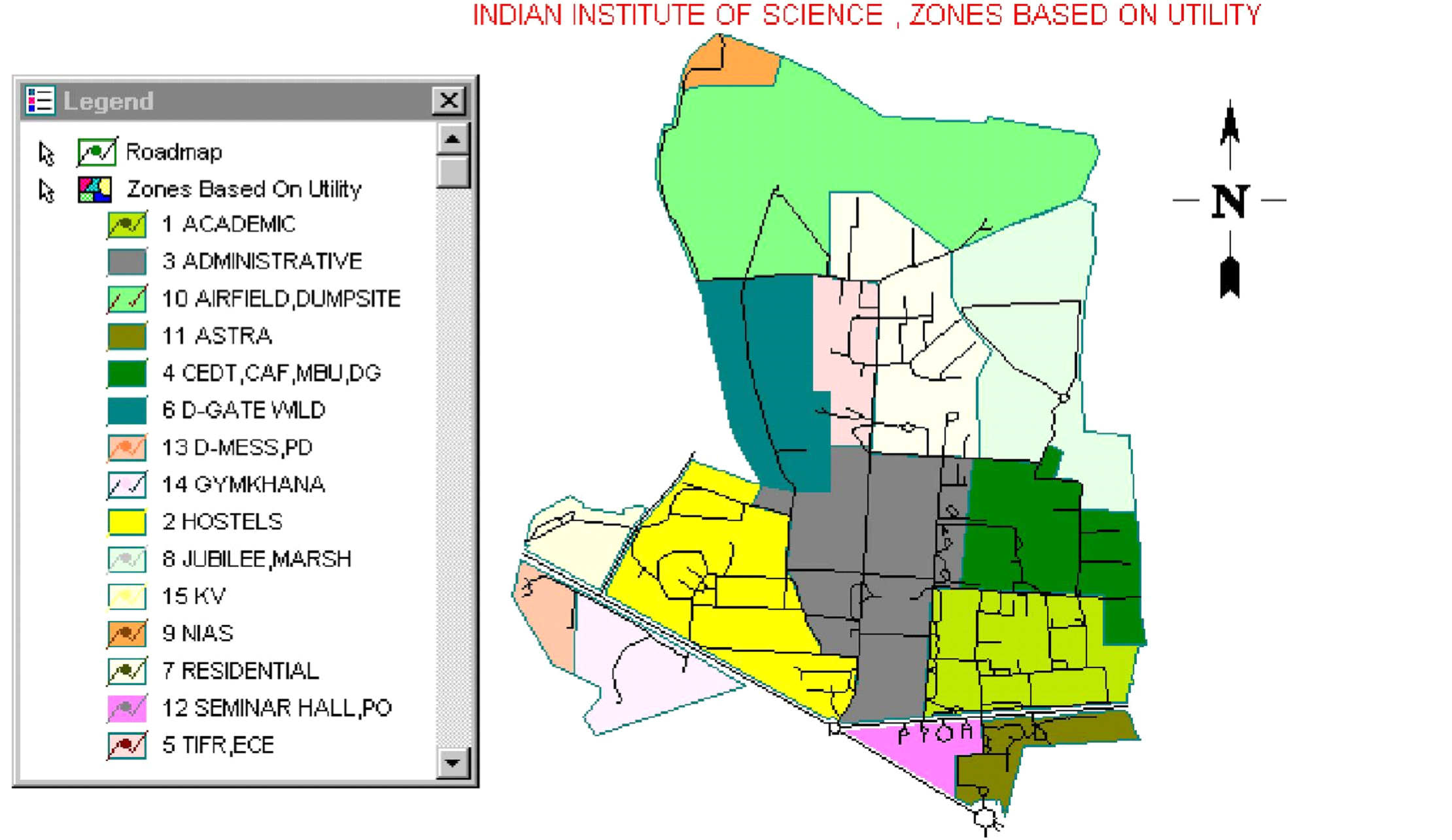
Figure 6: Road network of IISc campus.
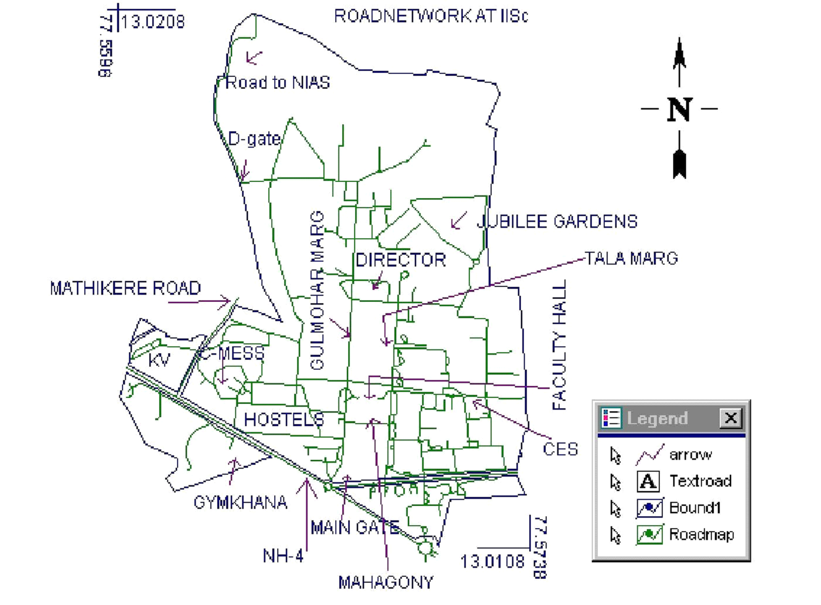
Figure 7: Drainage network of IISc campus overlaid on contours.
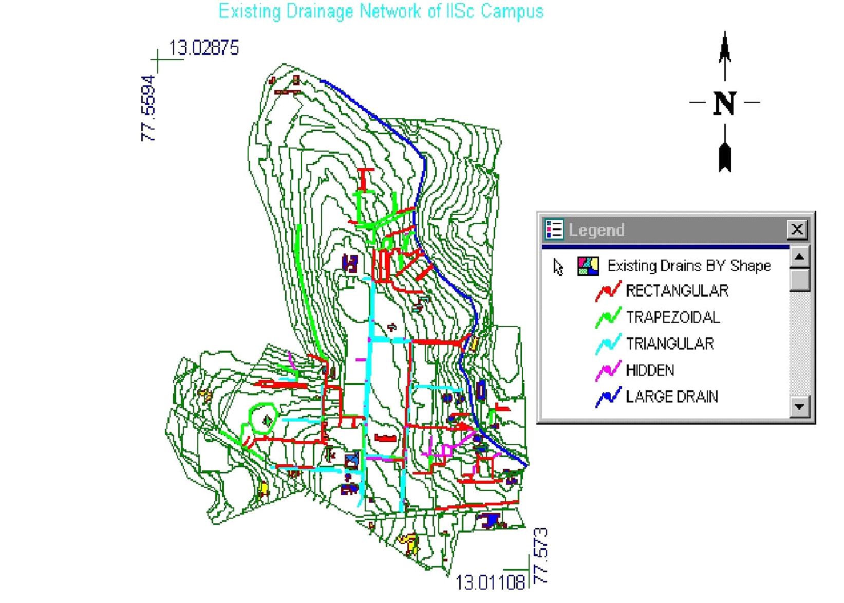
Figure 8: Rain Water Harvesting Site in IISc.
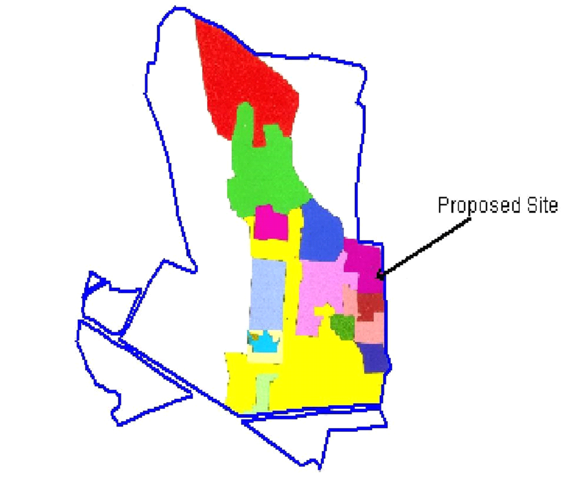
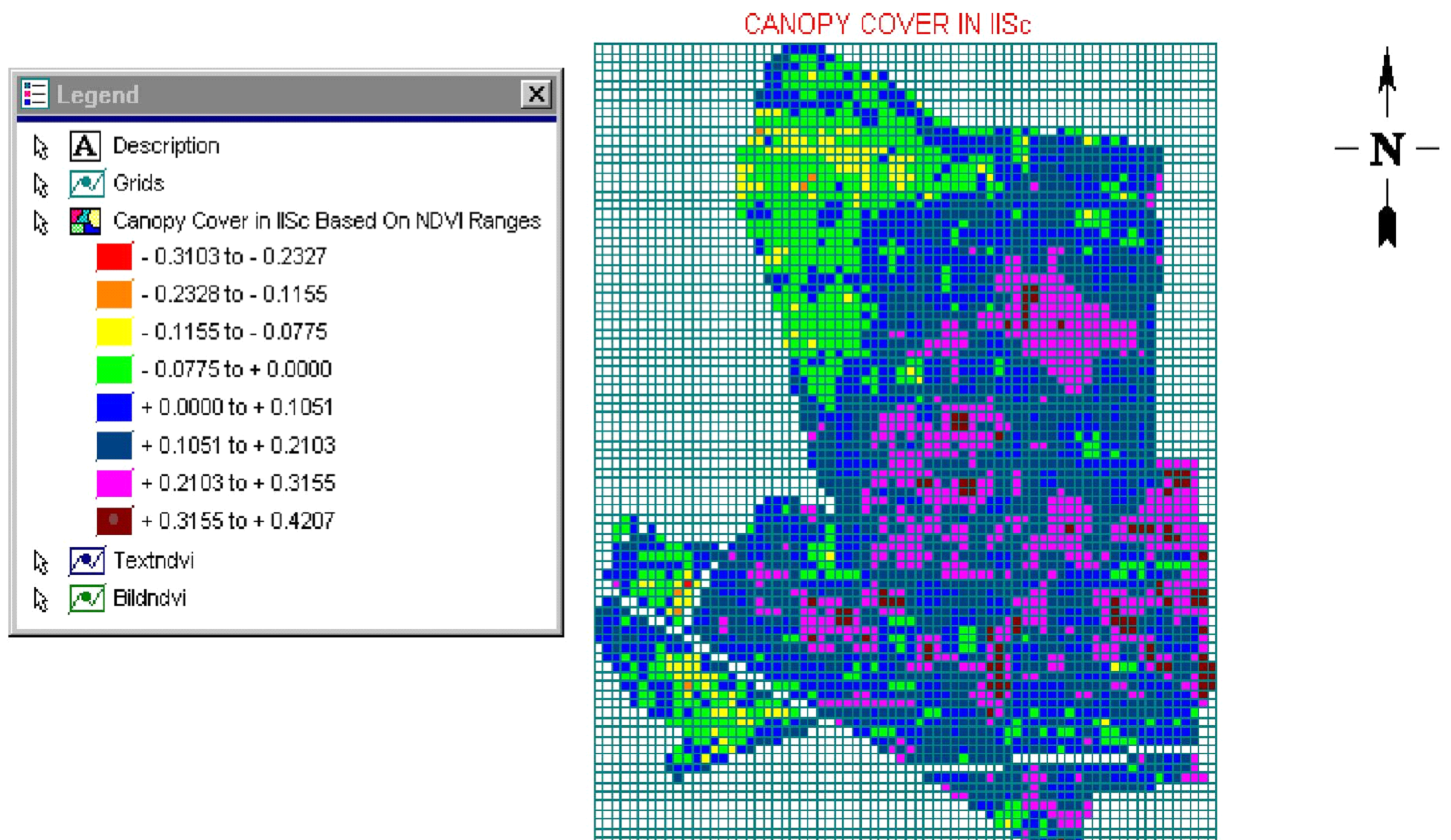
Figure 9: Canopy Cover of IISc Campus based on NDVI Ranges.
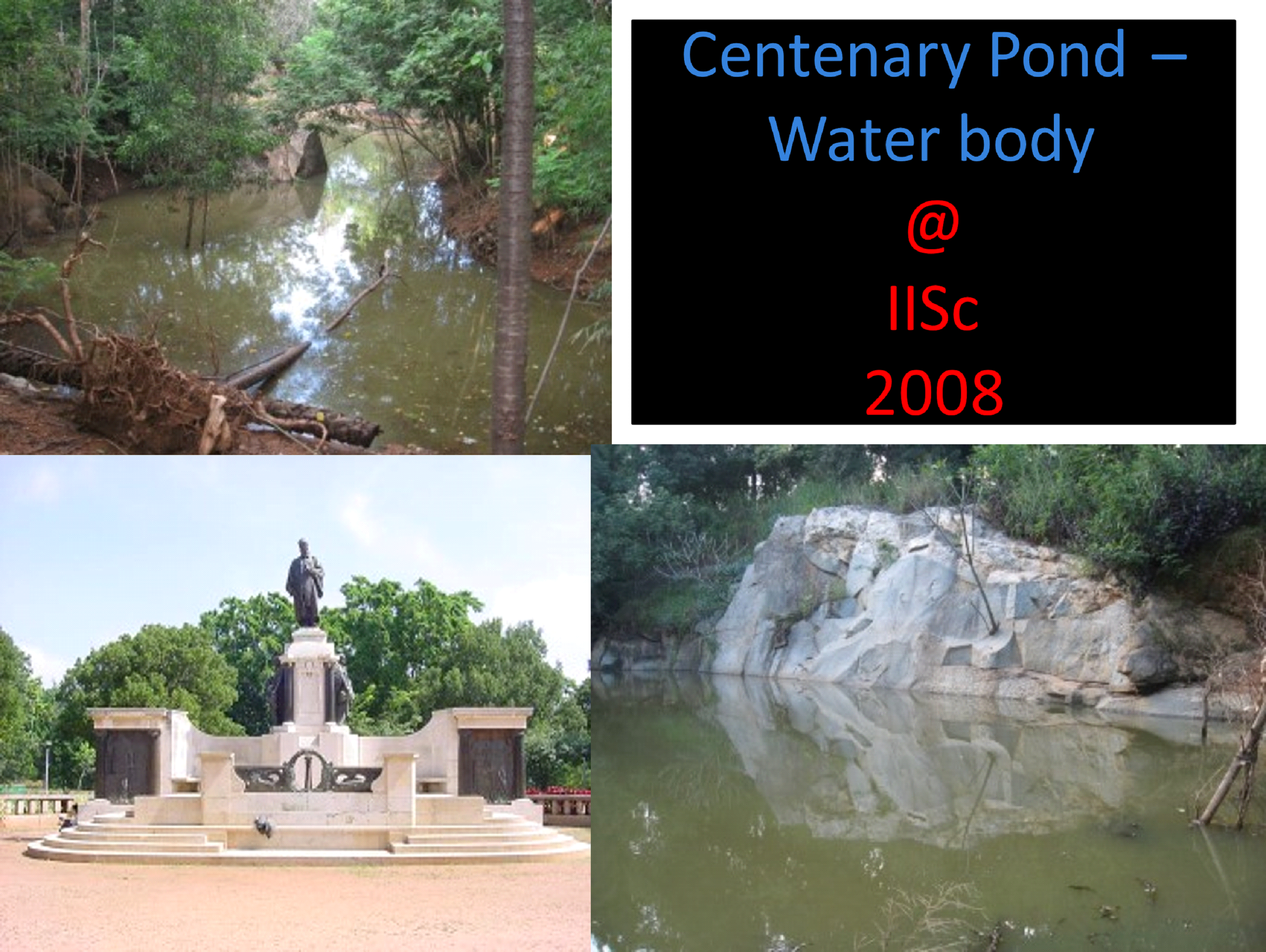
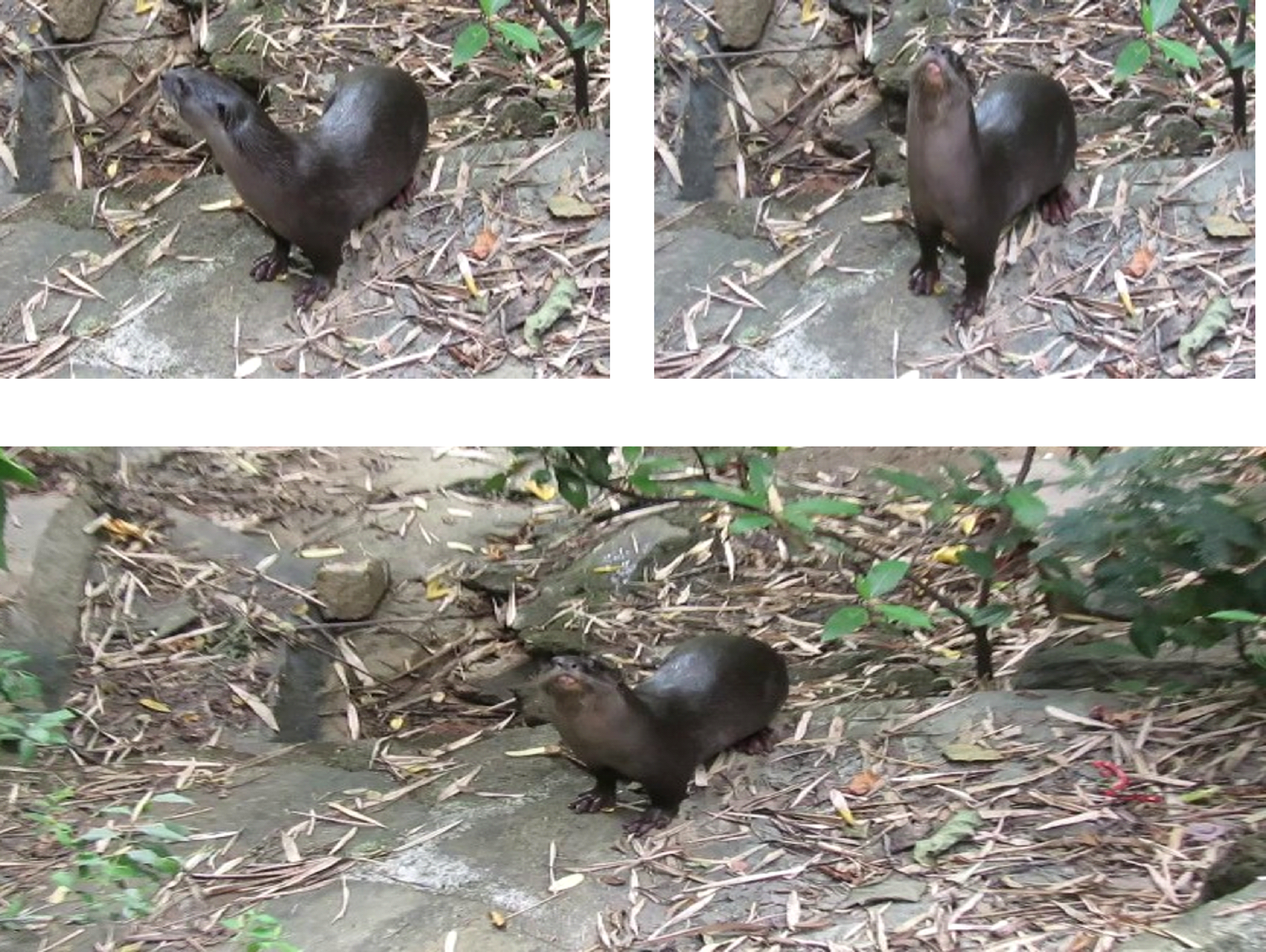
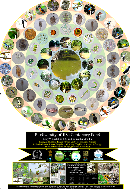
Design and Implementation of a waterbody at IISc campus - Harvesting 10 Lakh Litres of rainwater Water harvesting - Centenary pond at IISc campus: Taking advantage of the undulating terrain in the campus, a water body was implemented in a low-lying area, which has been storing ten lakh liters of rainwater every year since 2010. This region has a rich biodiversity with otters, fish, and a variety of microalgae. This pond (centenary pond) has been aiding as an open lab for biodiversity studies by interns (part of environmental education programme - 2-3 youngsters, school and college students are allowed to learn the structure and functional aspects of ecosystems. |
|
Planting native (ficus) species - 500 saplings on 14 November 2017 involving school children at Jubilee Garden (closer to the Centenary Pond) |