Study area
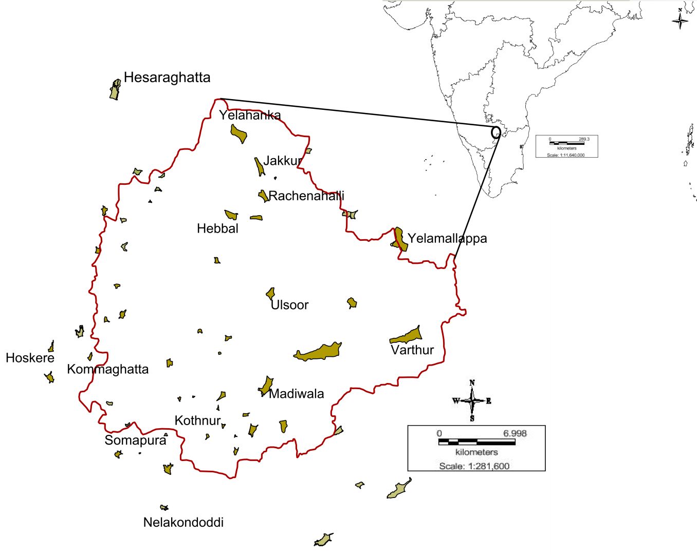
The studied wetlands are shown in Figure 1. Polluted, reference and restored wetlands fall within the Bangalore region at a latitude of 12.95º N and longitude of 77.57º E and altitude of 920 meters a.m.s.l. The spatial extent of the region is about 900 sq.km., with an annual precipitation of 924 m and the temperature varying from ~15º C (January) to ~36 ºC (April/May) (http://www.imd.gov.in accessed on 21/12/2012). Kempegowda, the founder of Bangalore constructed several lakes during the 16th century to meet the domestic water needs (drinking, irrigation, etc.). These lakes with biological entities function as wetlands and have been recognized as wetlands as per Ramsar Conventions. During the 19th century, industrialization paved way for the conversion of major watersheds into residential and commercial areas, causing a decline in the number of wetlands. Rapid urbanization in recent times has led to 63.2% increase in built-up area (from 1973 to 2010) and the loss of 78% waterbodies and 76% vegetation cover (Ramachandra et al., 2012). Sewage generated in the city is either untreated or partially treated that finally gets into these waterbodies leading to the enrichment of nutrients due to the sustained inflow. An earlier analysis has revealed an increase in air temperature by 2oC annually (Ramachandra and Kumar, 2008). Bangalore being located on a ridge has four watersheds namely Hebbal, Koramangala, Challaghatta and Vrishabhavathi with an interconnected wetland system. In this study, five wetland types were selected for monitoring the changes during prior-restoration (PRR) and post-restoration (POS) periods. In addition to these, three polluted (POL) wetlands , three reference (REF) wetlands and three previously restored wetlands (PVR) were monitored for comparative assessment of water quality (refer Table 1).
Figure 1: Bangalore Map showing studied wetlands