STUDY AREA |
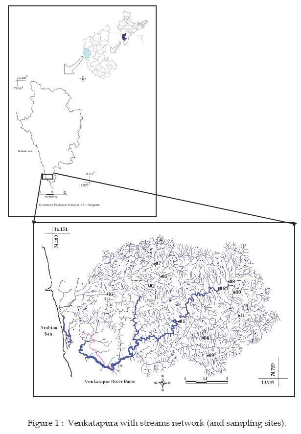
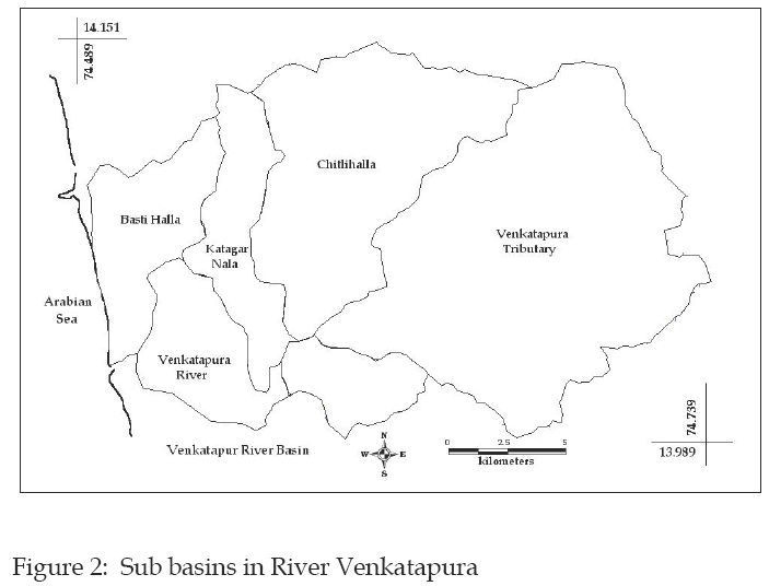
The Venkatapura river is located between 13.98° - 14.15° N and 74.48°- 74.73° E in the southern part of Uttara Kannada district of Karnataka, India (Figure 1). It originates in Western Ghats and confluence into Arabian Sea after a course of 45 km near Venkatapura with a catchment of 335 km2 (Kamath, S.U., 1985). Forest and agriculture are the major land use in the catchment. The river basin is divided in to six sub basins namely Venkatapura tributary, Chitihalla, Katagar Nala, Basti Halla, Kitrehole and Venkatapura river (Figure 2) based on major tributaries.