ENVIS Technical Report: 95, August 2015 |
 |
DETRIMENTAL LANDUSE CHANGES IN AGARA-BELLANDUR WETLAND
| 
|
| T.V. Ramachandra1,2,* |
Vinay .S1 |
Bharath H. Aithal1 |
1Energy and Wetlands Research Group, Centre for Ecological Sciences,
Indian Institute of Science, Bangalore 560 012
2Centre for Sustainable Technologies,
Centre for infrastructure, Sustainable Transportation and Urban Planning (CiSTUP)
*Corresponding author: cestvr@ces.iisc.ac.in,
energy@ces.iisc.ac.in [080-22933099]
Citation: Ramachandra T V, Vinay S and Bharath H.Aithal, 2015. Detrimental landuse changes in Agara-Belllandur wetland, ENVIS Technical Report 95, CES, IISc, Bangalore, India
|
|
LANDSCAPE DYNAMICS AND ALTERATIONS IN RAJAKALUVE
|
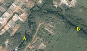
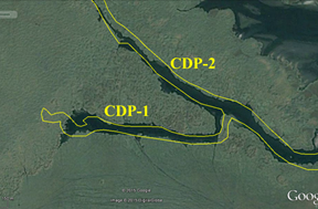
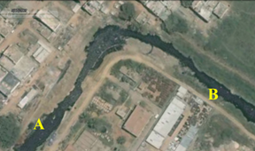
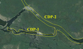
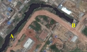
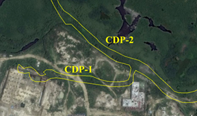
Wetlands in Bangalore are inter connected and these inter connected systems facilitate transfer of water from one lake to other lake via wetlands. Figure 11 highlights interconnected lake system in Agara-Bellandur region with rajakaluves and stream network. Figure 11 also indicates the narrowing down of rajakaluves which is explained in figure 12 (12a to 12 c) for the period 2000 to 2015, (for the cross sections A, B, C, D are marked in figure 11 and figure 12 respectively). Table 2 provides the declining width of rajakuluve with the progress of construction activities in the region. Rajakauluves have declined between 23% and 57% of the original width during the year 2000 to 2015.
 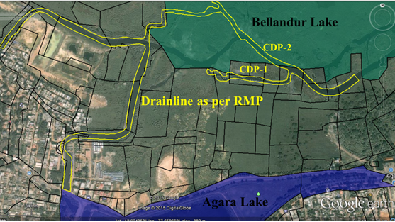
Figure 11: Rajakaluve, streams and lakes as per cadastral maps, satellite data and RMP 2015
|

|
|
a) 2000 |
|

|
|
b) 2007 |
|

|
|
c) 2015 |
Source : Google earth |
Figure 12: Alterations in the rajakaluve/storm water drain since 2000
Table2: Shrinking width of the rajakaluve (all unit in metres)
Year |
A |
B |
C |
D |
CDP 1 |
CDP 2 |
Cadastral Map |
45 |
40 |
35 |
- |
- |
- |
2000 |
30 |
30 |
30 |
- |
22.53 |
23.89 |
2005 |
25 |
22 |
30 |
21# |
14.95 |
21.27 |
2007 |
23 |
22 |
30 |
35 |
14.95* |
21.27* |
2010 |
23 |
22 |
21 |
35 |
Filled |
21.27 |
2012 |
23 |
15 |
18 |
16 |
Filled |
21.27 |
2015 |
23 |
18 |
18 |
15 |
Filled |
21.27* |
# not accurately measurable due to wetlands vegetation along the flood plain |
* Macrophyte cover |
>
| |


