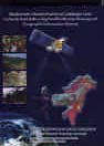
Biodiversity Characterization at Landscape Level in North-East India using Satellite Remote Sensing and Geographical Information System
T. V. Ramachandra1,* and A. V. Nagarathna2
|
Biodiversity Characterization at Landscape Level in North-East India using Satellite Remote Sensing and Geographical Information System T. V. Ramachandra1,* and A. V. Nagarathna2 |
|
| 1 Energy and Wetlands Research Group,
Centre for Ecological Sciences, Indian Institute of Science, Bangalore 560 012, India *e-mail: cestvr@ces.iisc.ac.in 2 Biodiversity Unit, Jawaharlal Nehru Centre for Advanced Scientific Research, Jakkur, Bangalore 560 064, India |
|
|
Biodiversity or biological diversity generally refers to the variability among living organisms from all sources including, inter alia, terrestrial, marine and other aquatic ecosystems and the ecological complexes of which they are a part. This includes diversity within species, between species and of ecosystems. Thus, biodiversity is the totality of genetic, species, ecosystem and habitat diversity in a region that has evolved through millions of years of evolutionary history. It changes across environmental gradients like latitude, altitude, depth, aridity, etc. Inventorying and monitoring of biodiversity is done at different organizational levels from genes to ecological systems (landscapes), and at different spatial scales from a few square meters to continents. Hence, the recognition and characterization of biodiversity depends critically on taxonomy, genetics and ecology. Taxonomy provides the reference system and depicts the pattern or tree of diversity for all organisms. Genetics gives a direct knowledge of the gene variations found within and between species. Ecology provides knowledge of the varied ecological systems in which taxonomic and genetic diversity is located, and of which it provides the functional components. The origin of life is a consequence of pre-biotic evolution of organic material to cellular forms. The present complexity that life has developed by successive evolutionary optimization took 3.5 to 4.0 billion years (earliest fossil record of life on earth is 3.6 billion years ago). An estimated 1.7 million species have been described to date, and conservative estimates suggest that around 12.5 million species must be existing on earth. This rich diversity is facing various threats for its very survival. Even before we fully describe the species richness, we are losing many species, due to the alarming rate of extinction. It is hard to develop a measure of extinction rates of the entire flora and fauna due to the scant knowledge of the species pool before the impact. Even though speciation and extinction processes (as many as 12 mass extinctions have taken place so far naturally) are part of the evolutionary process, extinction is overtaking speciation. Humankind has to realize that what is lost is lost forever, and cannot be brought back. Human development should be without interfering with natural ecosystems that exist, rather should be in harmony with nature, conserve it for the future generations. Why are species going extinct at a phenomenal rate? The loss of biodiversity could be attributed to the expanding human population activity by way of habitat destruction through fragmentation and degradation, overexploitation of species for human use, introduction of exotic species, increased spread of disease, predators and many other complex unexplored factors. The fundamental questions that need to be addressed for conservation are – Why conserve biodiversity? What to conserve? Where to conserve? How rapidly can ecosystem be conserved? What should be the priorities and strategies? How well can a conservation and management project be designed and implemented? How best can the interdisciplinary and contemporary latest technologies/methodologies be applied? and how accurately can patterns of biodiversity be predicted by applying these technologies? The book under review provides useful guidelines for answering most of these questions. Biodiversity is important to humankind in fulfilling its needs by way of providing food (80,000 species), medicine (20,000 species), drug formulations (8,000 species) and raw materials (90% from forests) for industry. India is one of the mega-biodiversity countries in the world (hosting 75,000 species of fauna and 45,000 species of flora). India is also a Vavilovian centre of origin and diversification of cultivated plants (with approximately 167 species of agri-horticulutral crops and 320 species of their wild relatives). India is identified as one of the important biodiversity pools, known for genetic, ecological and economic prudence. One of the major challenges for us is to conserve and sustainably manage this rich biodiversity, which is fast depleting. India being a signatory to the Convention on Biological Diversity needs to take up immediate measures to check the current rates of biodiversity loss. In recent times, laudable attempts have been made to identify biodiversity hot-spots and unique habitats, and to preserve, protect and propagate them through in situ and or ex situ measures. Assessing biodiversity in the regions of megadiversity is a gigantic task. Depiction of ecosystems in India, harbouring around 120,000 known plants and perhaps another 400,000 as yet undescribed species of plants, microbes and animals is possible with the recent technological advances in spatial and temporal analyses. In early 90’s, efforts were focused on supplementing field-based observations with remote sensing observations. The challenge was to prove that units identified on remote sensing data represent a unique composition. The advantage of remote sensing is that it also identifies the vegetation/landuse units which are likely to be missed during field surveys because of limitations in sampling techniques. The technology that has given vast scope to the applicability of remote sensing-based vegetation maps is ‘Geographic Information System (GIS)’. The availability of spatial and temporal technologies like GIS and remote sensing (RS) has immense application in landscape ecology. Landscape ecology considers vegetation as a mosaic of patches of vegetation with unique landform, species composition and disturbance gradient and focuses on parameters such as patch sizes, patch shapes, patch isolation, interspersion (adjacency of various landuses/landcover), juxtaposition (relative importance of adjacent patches), fragmentation, patchiness, etc. All these parameters have direct bearing on the status of biodiversity within a forest ecosystem. Ecological parameters like forest fragmentation, porosity, patchiness, juxtaposition, interspersion, etc., are required to compute disturbance index. Field data with respect to species richness, ecosystem uniqueness, biological values, etc., and collateral data, help to arrive at biological richness of the forest types in each region. Based on these parameters, prospecting of regions for conservation prioritization at the regional level can be done by making use of GIS, remote sensing and landscape ecology. This involves integrating spatial data like land use, land cover, disturbance regimes and biological richness maps with non-spatial data like taxonomic and genetic information; and creating landscape level information linked with a comprehensive plant species database. Advances in remote sensing satellite sensors with better spectral and spatial resolutions, allow assessment and monitoring of vegetation cover and its related attributes. GIS allows the building of a comprehensive database on various parameters which govern spatial distribution of biodiversity. The utilization of landscape principles coupled with remote sensing and geographical information system help characterize fragmentation, disturbance regimes and biodiversity. The habitat definitions in the form of vegetation cover types will allow for ‘what to look where’. The disturbance regimes assessed across the landscape will allow focusing on the ecosystems which are under ‘stresses’. Detailed inventories of vegetation, habitats and biodiversity are useful in formulating the strategies for biodiversity conservation and sustainable utilization. The book under review demonstrates effectively with case studies the integration of landscape principles with remote sensing and geographic information system (GIS) for biodiversity characterization at landscape level. This publication gives an excellent account of the major initiative undertaken by the Department of Space (DOS) and the Department of Biotechnology (DBT) of the Government of India (GOI) for implementation of Genes to Ecosystem concept in biodiversity conservation and prospecting. It presents the geospatial database on vegetation cover types, biological richness and disturbance regimes at landscape level for North-East India – comprising states, viz. Assam, Arunachal, Manipur, Meghalaya, Mizoram, Nagaland, Tripura and Sikkim. This region is often referred to as a bowl of biodiversity due to its broad range of ecological habitats, floristic richness and high levels of endemism. This study has been undertaken after reviewing similar endeavours and adopts improved strategies considering the limitations of the conventional approaches. Biodiversity of natural landscape is not depicted in conventional methods, as it focused mainly on computation of species richness, species dominance and similarity indices based on phytosociological data or floristic survey. Landscape ecological principles provide insight to the natural and anthropogenic factors that influence the distribution of biodiversity. In this regard, the application of GIS proved successful in integrating spatial data like land use, land cover, disturbance regimes and biological richness maps with nonspatial data like taxonomic and genetic information and creating landscape level information linked with a comprehensive plant species database. This study is successful in utilizing the landscape principles along with remote sensing and geographical information system to characterize fragmentation, disturbance regimes and biodiversity. Bio_CAP, a customized software developed at IIRS for biodiversity characterization, was used to carry out multicriteria spatial analysis that facilitated the rapid assessment of biodiversity and its monitoring (loss and/or gain), assessment of nature of habitats and disturbance regimes therein, evolving, species–habitat relationships, mapping biological richness and gap analysis, prioritizing conservation and bioprospecting and redefining ecological zones required for biodiversity conservation. Ancillary data used in this study includes: value-added satellite data products on 1 : 250,000 scale for all scenes (hardcopy) and digital data of IRS-ID LISS III (wherever the quality was bad, IRS-1B/1C LISS-II data or Landsat-TM data was used), DEM (Digital Elevation Models), Survey of India toposheets, information about forest types of India, biogeographical digital map (from Wildlife Institute of India), climate maps of NATMO (from NBSS and LUP), socioeconomic data of national census, forest maps (from Forest Survey of India) and digital data about administrative boundaries (from Survey of India), groundbased inventory and the knowledge base. State-wise vegetation maps were collected from many institutions that participated in this study. Edge matching was done between boundaries of adjoining states with standard false colour composite as a reference to eliminate the sharp edges. State-wise legends of the vegetation map were then standardized for each region. The corrected maps were mosaiced into a single map and same procedures were then followed for each region. The satellite data provided key inputs like vegetation type, which is used for deriving several landscape indices (porosity, patchiness, fragmentation, interpersion and juxtaposition) depicting the status of a forest ecosystem. Ancillary database on roads and settlements has been utilized to prepare a proximity buffer map. All these parameters were used to derive the disturbance index map, while the digital elevation model was used to prepare terrain complexity map. All these parameters were integrated together with the field data on species richness, ecosystem uniqueness and biodiversity value. The resultant map gives the biological richness. For map composition, only important layers like vegetation type, fragmentation, disturbance regimes and biological richness were considered. District, state and international digital boundary of SOI were superimposed on the raster layers. Each map consisted of vegetation map, fragmentation map, disturbance regimes map, biological richness map, location map of the region with respect to India and IRS 1C LISS-III path and row references. The scale of each map varies with respect to its spatial extent. The states of Assam, Arunachal Pradesh, Manipur, Meghalaya, Mizoram, Nagaland, Tripura and Sikkim have been discussed at great length with the spatial information relating to their biodiversity, landscape, vegetation, phytosociological aspects, species diversity, endemic species, ecologically important species, economically important species, medicinal plants, disturbance regime, biological richness zones, etc. Fragmentation in this region is mainly due to jhum cultivation, human population pressure, industrial logging and ineffective government policies. Of the 16 major forest types, 13 types and 54 ecologically stable formations are observed. Tropical evergreen forest possesses highest diversity in Arunachal Pradesh followed by Mizoram, Assam, Nagaland and Tripura. Tropical semi-evergreen forest (which is highly fragmented in this region) has highest diversity in Arunachal Pradesh, followed by Meghalaya, Assam, Nagaland, Manipur and Mizoram. Moist deciduous forest has the highest diversity in Arunachal Pradesh followed by Assam, Nagaland, Manipur and Tripura. Sub-tropical evergreen forest has highest diversity in Arunachal Pradesh followed by Sikkim, Mizoram and Meghalaya. Sub-tropical semi-evergreen forests are observed in eastern part of Arunachal Pradesh with high diversity. Temperate mixed forests are least disturbed in many states as they occur in higher altitudes away from human habitation. Riverine forests have average species diversity. Thus, species diversity observed in this region indicates that it has a unique phylogenetic, geographic and ecological history that has shaped contemporary biodiversity. Overall rate of endemism declined from tropics to sub-tropics, temperate and alpine zone. Twelve chapters in this book are well framed, systematically and meaningfully arranged, and lucidly written with numerous references to date. A brief introduction to landscape ecology, satellite remote sensing and geoinformatics (chapters 1–5) helps the reader to familiarize with the basics of these disciplines and how best these can be applied to biodiversity conservation, management and planning. The schematic representation through flowcharts and colour maps/photos are very informative and appealing. State-wise list of endemic species, economically and medicinally important plant species are very useful and informative. Methodology adopted in sampling, image classification, landscape analyses, computation of disturbance and biological indices which are presented in the ninth chapter impart new directions and approaches to biodiversity research. Intra- and inter-chapter linkages provide a complete state of development. Tenth and eleventh chapters give comprehensive picture of the biodiversity status in all north eastern states with landscape analysis, variation in diversity in spatial scales, interpretation of situations, illustrations and synthesis of a complex phenomenon of bioprospecting for defining ecological zones required for biodiversity conservation. This book provides a basic technical and scientific introduction to an important scientific activity, so that readers will understand better the need for spatial and temporal analyses in addressing the problem of conservation and sustainable management of ecosystem, and stimulate discussion on the potential of GIS and RS for inventorying and monitoring of variation in biological diversity. This book is informative and well written and offers a fine compilation of useful, practical information and serves as a ready reference to practising ecologists, conservation researchers, managers, planners and policy/decision makers.
|