Objectives |
Primary goal of this investigation is to explore and assess various techniques that could be adopted for land cover and land use analysis for regional bioresource monitoring. Land use analysis helps to gain insight into the data for area based energy planning and problems related to the resources availability, collection, etc. The objectives are:
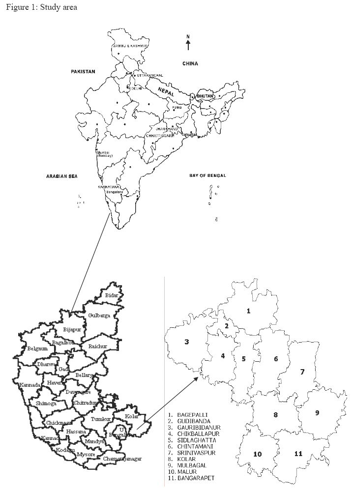
Kolar District is located in the southern plains of Karnataka State, India. It lies between 77deg 21' to 78deg 35' east longitude and 12deg 46' to 13deg 58' north latitude and extends over an area of 8,225 Sq. km (Figure 1). The population was 2.523 millions in 2001. For administrative purposes the District has been divided into 11 Taluks. There are 15 towns and 3,325 inhabited villages in the district. Kolar belongs to the semi arid zone of Karnataka. In the semi arid zone apart from the year-to-year fluctuations in the total seasonal rainfall, there are also large variations in the time of beginning of rainfall, adequate for sowing as well as in the distribution of drought periods within the crop-growing season. Kolar district depends on the rainfall during southwest and northeast monsoon. Out of about 2800 sq. km. of land under cultivation, 35% is under well and tank irrigations. There are about 951 big tanks and 2934 small tanks in the district.
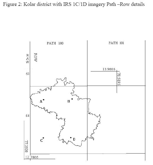
The data sets needed to develop the vegetation database included village maps, Survey of India toposheets (1:50000, 1:250000), satellite images (multispectral and panchromatic sensor data) and information from field surveys (training data) using global positioning system (GPS). In order to take into account variation in spectral values due to climatic factors (seasonality), remote sensing data at different time intervals were considered. Cloud free images from space borne sensors of IRS 1C and 1D were used for this purpose. Satellite imageries of Path 100 - Row 63, Path 100 - Row 64 and Path 101 - Row 64 provide the entire image of Kolar district (Figure 2).