NAME
d.rhumbline - Displays the rhumbline joining two longitude/latitude coordinates.KEYWORDS
display, distance, rhumblineSYNOPSIS
d.rhumbline
d.rhumbline --helpd.rhumbline coordinates=lon1,lat1,lon2,lat2 [line_color=name] [--help] [--verbose] [--quiet] [--ui]
Flags:
- --help
- Print usage summary
- --verbose
- Verbose module output
- --quiet
- Quiet module output
- --ui
- Force launching GUI dialog
Parameters:
- coordinates=lon1,lat1,lon2,lat2 [required]
- Starting and ending coordinates
- line_color=name
- Line color
- Either a standard color name or R:G:B triplet
- Default: black
Table of contents
DESCRIPTION
A rhumbline (loxodrome) is a line following a constant angle of the compass (i.e., a line of constant direction). It crosses all meridians at the same angle, i.e. a path of constant bearing. d.rhumbline displays the rhumbline joining any two user-specified points in the active frame on the user's graphics monitor. The named coordinate locations must fall within the boundaries of the user's current geographic region.The user has to specify the starting and ending longitude/latitude coordinates of the rhumbline and (optionally) the color in which the rhumbline will be displayed; in this case, the program will run non-interactively.
EXAMPLE
A geodesic line if shown over the political map of the world (demolocation dataset):g.region vector=country_boundaries -p d.mon wx0 d.vect country_boundaries type=area d.rhumbline coordinates=55:58W,33:18S,26:43E,60:37N \ line_color=yellow # show additionally 10 degree grid d.grid 10
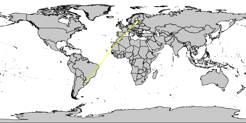
Rhumbline (loxodrome)
NOTES
This program works only in GRASS locations with longitude/latitude coordinate system.SEE ALSO
d.geodesic, d.grid, m.measureAUTHOR
Michael Shapiro, U.S. Army Construction Engineering Research LaboratorySOURCE CODE
Available at: d.rhumbline source code (history)
Latest change: Thursday Feb 03 11:10:06 2022 in commit: 547ff44e6aecfb4c9cbf6a4717fc14e521bec0be
Main index | Display index | Topics index | Keywords index | Graphical index | Full index
© 2003-2023 GRASS Development Team, GRASS GIS 8.2.2dev Reference Manual