Note: This document is for an older version of GRASS GIS that will be discontinued soon. You should upgrade, and read the current manual page.
NAME
d.text - Draws text in the active display frame on the graphics monitor using the current font.KEYWORDS
display, cartographySYNOPSIS
d.text
d.text --helpd.text [-pgbrs] [text=string] [input=name] [color=string] [bgcolor=string] [rotation=float] [linespacing=float] [at=x,y] [line=integer] [align=string] [font=string] [size=float] [path=name] [charset=string] [--help] [--verbose] [--quiet] [--ui]
Flags:
- -p
- Screen position in pixels ([0,0] is top left)
- -g
- Screen position in geographic coordinates
- -b
- Use bold text
- -r
- Use radians instead of degrees for rotation
- -s
- Font size is height in pixels
- --help
- Print usage summary
- --verbose
- Verbose module output
- --quiet
- Quiet module output
- --ui
- Force launching GUI dialog
Parameters:
- text=string
- Text to display
- input=name
- Input file
- color=string
- Text color, either a standard GRASS color or R:G:B triplet
- Default: gray
- bgcolor=string
- Text background color, either a standard GRASS color or R:G:B triplet
- rotation=float
- Rotation angle in degrees (counter-clockwise)
- Default: 0
- linespacing=float
- Line spacing
- Default: 1.25
- at=x,y
- Screen position at which text will begin to be drawn (percentage, [0,0] is lower left)
- line=integer
- The screen line number on which text will begin to be drawn
- Options: 1-1000
- align=string
- Text alignment
- Options: ll, lc, lr, cl, cc, cr, ul, uc, ur
- Default: ll
- font=string
- Font name
- size=float
- Height of letters in percentage of available frame height
- Options: 0-100
- Default: 5
- path=name
- Path to font file
- charset=string
- Text encoding (only applicable to TrueType fonts)
DESCRIPTION
d.text draws text in the active display frame on the graphics monitor. Text can be provided through standard input or redirected from a file (using the UNIX redirection mechanism). In addition to the options provided on the command line, colors, text size, font type, rotation angle, and boldness can be adjusted with commands in the standard input (i.e., if the user invokes d.text without options on the command line, and then assigns values to these options on lines within the standard input).Commands:
- .C color
- (where color is one of the available colors) causes text appearing on subsequent lines to be drawn in that color.
- .G color
- (where color is one of the available colors) causes the background of text appearing on subsequent lines to be drawn in that color.
- .S size
- (where size is a percentage within the range 0 to 100) adjusts text size. Note that a size of 10 would allow 10 lines to be drawn in the active display frame, 5 would allow the drawing of 20 lines, and 50 would allow the drawing of 2 lines.
- .F font
- (where font is one of the fonts known by the GRASS program d.font) manipulates the font type. Available fonts are listed in the GRASS manual entry for d.font. The default font type used (if unspecified by the user) is romans.
- .R rotation
- (where rotation is an angle in degrees, counter-clockwise) to rotate the text.
- .B 1
- stipulates that following text be printed in bold. This command means bold on.
- .B 0
- turns bold off of all text appearing on lines beneath it. (Bold off is used by default, if unspecified by the user.)
EXAMPLE
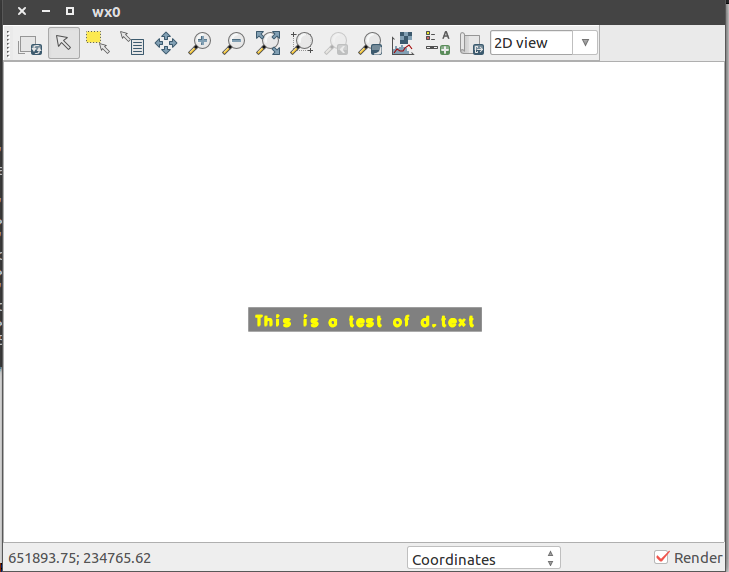
The following command will print the short phrase "This is a test of d.text" in the active display frame using the color yellow, in bold, and using 4/100'ths (4%) of the active frame's vertical space per line:
d.text text="This is a test of d.text" color=yellow bgcolor=gray size=4

Displayed Text
NOTES
Note that the GRASS command d.title creates map TITLEs in a format suitable for input to d.text.d.text needs escape sequences that can be used within lines to change colors, boldness, and perhaps size.
SEE ALSO
d.fontd.title
d.labels
AUTHOR
James Westervelt, U.S. Army Construction Engineering Research LaboratoryUpdates by Huidae Cho
SOURCE CODE
Available at: d.text source code (history)
Latest change: Mon Nov 18 20:15:32 2019 in commit: 1a1d107e4f6e1b846f9841c2c6fabf015c5f720d
Note: This document is for an older version of GRASS GIS that will be discontinued soon. You should upgrade, and read the current manual page.
Main index | Display index | Topics index | Keywords index | Graphical index | Full index
© 2003-2023 GRASS Development Team, GRASS GIS 7.8.8dev Reference Manual