|
Ground
and Aerial Photographs of the Morro Bay Area
|
This page is a gallery of mostly ground photos taken by the writer (NMS)
during two visits to Morro Bay, in 1995 and again in 1999. These provide a
means for the viewer to gain a feel for what the towns and natural features
in this area actually look like, so as to better correlate the TM subscene’s
contents with their counterparts as these appear on the surface. An aerial
oblique photo covers much of the same area and should serve as the reference
in comparing scene characteristics between the TM vertical view and the more
familiar near surface manifestations.
Ground and Aerial Photographs of the Morro Bay Area
You can gain a feel for the
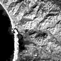
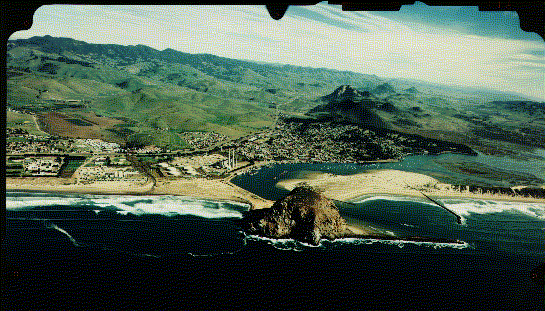
terrain and the town layout by looking at the next group of views. The first is
an aerial oblique photograph taken in mid-afternoon (note shadows) on January
25, 1988 (when, in winter, the grasses covering the hills and mountains are
green) looking east at the northern part of Morro Bay towards the hills in the
background. The town of Morro Bay is situated in the center of the photo. We
have digitized and enlarged this oblique photo to let you see details within the
vicinity of the town area. Click on the credit line or the image to enlarge it.
Use the scroll bars to see areas initially off screen.
(credit: Golden State
Aerial Surveys, San Luis Obispo, California, )
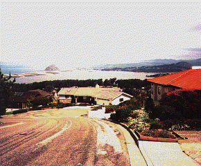
The second view was taken from a
hill slope within the town of Los Osos (Spanish for "The Bears"), about 8 km (5
miles) south of Morro Bay town, on the ground looking north-northwest across the
body of water named Morro Bay, with that town in the distance.
1-3: Glancing back and forth
between these oblique photos and the Band 3 image repeated below, try to locate
in the Landsat scene whatever ground features you note/identify in the aerial
oblique photo. Also, see if you can find in the Landsat image the approximate
place where the above land photo was taken. ANSWER
TM Band
3
Lets look at some of these features
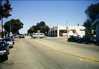
more closely, as photographed by the writer during two visits, in 1994 and 1999.
The town of Morro Bay is a popular tourist attraction streaming with visitors
much of the year. The Main street area is typical of many smaller California
towns located along the coast.
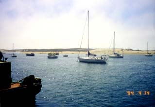
Its waterfront, called the
Embarcadero, is lined with shops, restaurants, and boat moorings, as seen here:
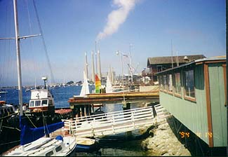
Note the three smokestacks of the
powerhouse, notable in the aerial oblique photo but hard to pick it in the
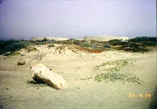
Landsat image, in the background. Behind this plant are five oil storage tanks,
conspicuous in both the aerial photo and the Landsat imagery; as seen from the
ground:
One surface feature stands out in
both the aerial photo and the panoramic ground scene: Morro Rock, a great
erosional monolith made of silicic volcanic rock (part of a chain known as the
Seven Sisters; other volcanic necks [central vents] also appear in this scene)
that reaches a height of 175 m. (574 ft) above the Pacific.
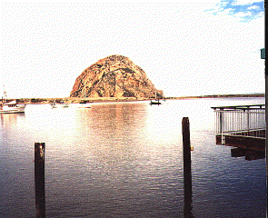
Technically, this is a sea stack,
an outlier of rock that became detached from the mainland as waves cut away at
the shoreline. Here, we see a narrow deposit of sand, caused by deposition in
shallow water. This sand bridge connects the stack with the mainland, producing
what is known as a "spit".
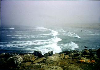
Just to its north is the public
beach against which waves break in a pounding surf; this picture was taken as
the ubiquitous summer fog was beginning to clear for the day.
Morro Bay itself is formed from a
long barrier island tied to the south end and open as an inlet near Morro Rock.
Exposed sand dunes occupy much of the surface but patches of low saltwater
vegetation are scattered over it:
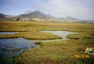
Extending into the bay near its
southeast end is a delta formed by a small river. This delta supports estuarine
and riverine vegetation as depicted in this east-looking view:
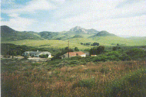
The southern side of the hills
running eastward and perpendicular to the ocean, with several conspicuous
volcanic peaks (other Seven Sisters), but vegetation-covered, appears in this
view taken from a point SE of Morro Bay town.
On the north side of these hills,
along Highway 1, the flat valley is given to agriculture. Seen in this photo are
fields of the main crop in the area - snow peas:
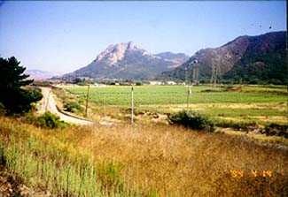
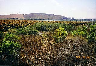
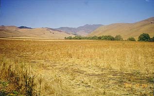
More widespread farming takes place
in the valley traversed by Highway 41. The brown area noted in the aerial
oblique photo is largely made up of Avocado trees, as seen here:
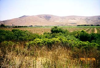
Other cultivated acreage include
snow peas and grapes (wine-producing), evident in this photo which also shows
the low grass-covered hills that make up much of the rolling topography inland
from the coastline:
The high coastal mountains to the
east of the Morro Bay-Baywood-Los Osos developments make up the Santa Lucia
Range, along which we find California Live Oaks and other trees and foliage that
comprise the northernmost extension of Los Padres National Forest in
south-central California. This high country (elevations above 700 meters [2200
ft]) as seen from the east side of Morro Bay is shown next, along with the brown
grassy foothills, and a stubble field in the foreground.
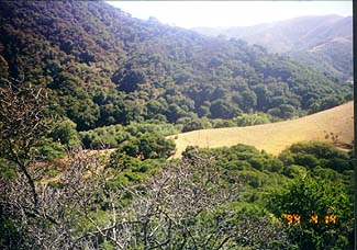
Denser forests extend from the
higher elevations (about 260 m or 850 ft, in the Landsat subscene) into the
lowlands along streams. The next view is a typical example.
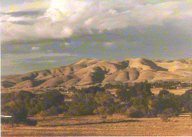
The hallmark of much of the
hillsides in both the Coast Range and Sierra Nevada foothills is the natural
grasses covering which reach their full greenery during the rainy season from
October through April. By May, these grasslands assume a pleasing golden
yellow-brown color that persists through Summer into early Fall. This brownish
background contrasts with the deep greens of the oaks and evergreens exemplified
in the next photograph.