|
Military Intelligence Satellites |
This page is devoted entirely to one of the prime uses of remote sensing that has driven the entire technology since the early days of the entry of satellites into space. Depending almost exclusively on imaging capabilities, "spy satellites" have been orbited by the hundreds (by several countries) to gather military intelligence or information about terrorist activities. Visible, Near-Infrared; Thermal Infrared, and Radar sensors are applied to gathering information about ground targets and activities of national security significance. Many of the military or intelligence satellites, up until recently, have had superior resolutions when compared with Space Agency systems.
Looking down and out (as from a mountain) to survey the battlefield for information useful to military leaders goes back to ancient times. In Napoleonic times, the French used observation balloons to scan their foes before and during battles. This technique was often a factor in the U.S. Civil War. By the First World War, airplanes and dirigibles were employed over enemy lines and their staging areas and cities as platforms from which aerial photography provided reconnaissance and intelligence pertinent to the content of battle. This approach was much expanded during the Second World War, as for example the follow-ups to a bombing raid to assess damage to the target. With the advent of rockets and then satellites, observations of both military and political activities on the ground became possible, ushering in the so-called Age of Spy Satellites. Besides surveillance of a wide variety of targets of interest to military intelligence units (in the United States, these include the Department of Defense, the CIA, the National Security Agency, and Homeland Defense), satellites can now assist in areas other than simply observing features on the ground - this includes communications, meteorology, oceanography, location (Global Position Systems [GPS]), and Early Warning Systems (none of these latter applications will be discussed on this page). In addition to satellites, manned aircraft continue to be platforms and in recent years UAV's (Unmanned Aerial Vehicles) such as drones have assumed some of the intelligence-gathering tasks.
As one would suspect, there is extensive coverage of "spy satellites" on the Internet, although much information remains classified and thus not released to the public. On this page, only the broadest outline of the history of military intelligence operations from the air and space in the last 50 years will be treated, along with some representative image examples that are now declassified into the public domain. The reader is offered these five Internet sites as among the best found by the writer. Two top the list: 1) An overview (click on that link) prepared by Federation of American Scientists, with an offshoot or link from the same organization that shows specific imagery; and 2) this site, with an information history supported by good imagery, produced by a group at George Washington University. Three others, simply enumerated here are also worth a visit: (1); (2); and (3). It's your choice, either visit these first or read further on this page (most images come from these Web pages just cited) and then check out the above sites.
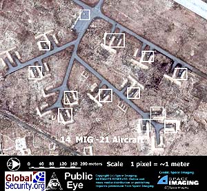
Before moving through this page, we suggest going to one more Web site that specifically includes the effects of spatial resolution in military satellite surveillance. This is again two of the links on the FAS Imint site (1)and (2). The single idea to draw from these illustrations is that military observations work best and reveal the desired intelligence when resolution is a few meters or better. Note what can be found and, more importantly, identified at each resolution level. For nearly four decades the military had high resolution systems that could not be matched by non-military earth observation systems (i.e., there were imposed limits of resolution below which (namely, towards greater/better resolution [picking out smaller objects]) no civilian space agency or private group were permitted to design into the sensors on the satellites they operated). All this changed in the 1990s when the Russians began to sell high resolution (~2 meters) imagery from their SPIN-2 on the open world market. After that the U.S. placed more than 800,000 of its earlier military space photos into the public domain.
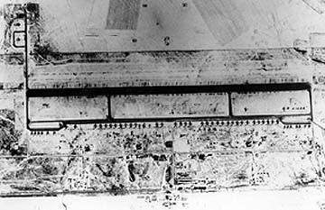
Now to some specifics: When one thinks of any postwar spy from the sky incidents, the first and most famous case that many recall was the U-2 high altitude airplane that was shot down over the Soviet Union during President Eisenhower's second term in which the pilot, Gary Powers, was captured and held for many months. Here is an example of a U-2 photo (from another mission) over a military air base.

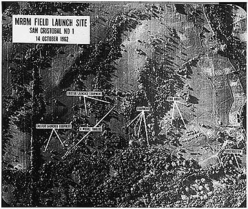
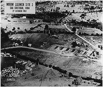
The U-2 achieved even more fame during the October 1962 Cuban Missile Crisis, when Pres. John F. Kennedy went to the brink with Soviet Chairman Nikita Krushchev over the installation of Medium and Long Range nuclear rockets in parts of Cuba. The next two U-2 images show the facilities that were in place before the Soviet/Cuban block agreed to remove these weapons (probably avoiding World War III or at least partial annihilation):
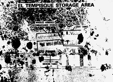
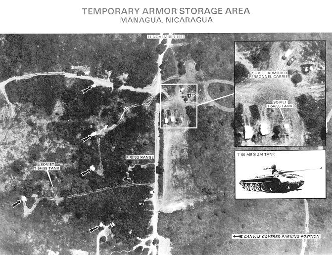
Added to this fleet of spy planes was the SR-71, known as the Blackbird. This photo shows a military storage base in Nicauragua (in 1987):
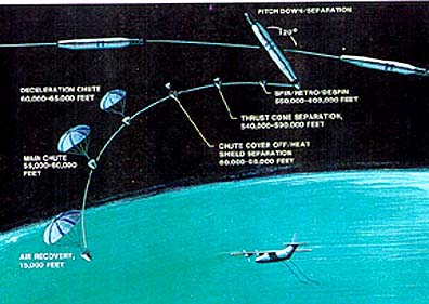
The first military satellites carried photographic cameras that had high resolution optics. The problem, of course, was that of retrieving the film. It could have been developed onboard like was done with the Lunar Orbiter pictures. Instead, the operators of this type of satellite chose to eject the (undeveloped) film towards Earth, with its container deploying on a parachute when the object entered the upper atmosphere. The film package was then "snatched" in mid-by an airplane sent to its expected point of entry. This seemingly difficult feat was remarkably successful, accomplished most of the time. This diagram shows the sequence:
The primary group of military
satellites used in reconnaissance and surveillance is known as the KeyHole
series. The first of these was placed in orbit in 1960 and used the parachute
retrieval system until 1972. Each numbered KeyHole mission series consisted of
multiple satellites. Different identifiers denoted specific satellite types that
varied in launch vehicle, orbital characteristics and satellite instrumentation.
For example, the KH-1 through KH-4 series also included the appellation Corona,
KH-5 is called the Argon series, and KH-6 the Lanyard. Each involved various numbers
of satellites. There were 105 successful Corona missions, which were operated
by the U.S. Air Force, with CIA involvement. Spatial resolution, initially about
2 meters with the first KH-1 launch in 1960 to work properly, steadily improved
with the higher KH numbers. To illustrate the types of images obtained (as photos)
from this early group (that constitute the now declassified images released during
the Clinton Administration), first examine this view of Moscow made by a KH-4
pass:
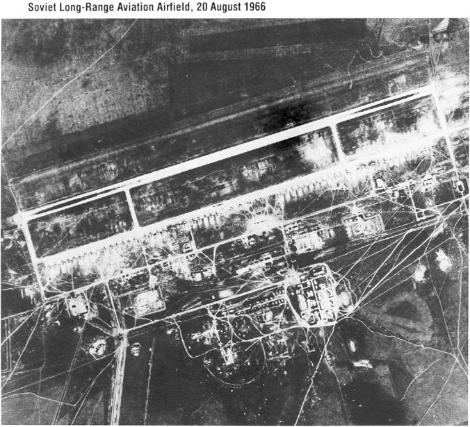
Next, examine this KH image
(specific group unspecified) of a Soviet Airfield.
All of the KH satellites,
of which more than 150 have been launched, consist of film cameras or electro-optical
cameras that view the ground through telescopes. KH-7 and KH-9, the Gambit series,
had resolutions of about 7 and 2.5 centimeters respectively. The KH-9 Hexagon
satellites had 5 to 10 meter resolutions. It is not clear from any of the Internet
sources consulted when 1) parachute drops ceased and 2) when electro-optical
scanners replaced film. But, KH-11 is designated as an ELINT type (Electronic
Intelligence) and did relay its imagery to receiving stations. The KH-11 Crystal
satellites produce both SWIR and Thermal Infrared imagery, suggesting a non-photographic
component. The KH-12 series, the last for which some specifications can be found,
is reputed to achieve a resolution of 2+ cm, although images of this sharpness
haven't been released. Below are several illustrations of declassified (but
less than optimum resolution) KH-11 and KH-12 images:
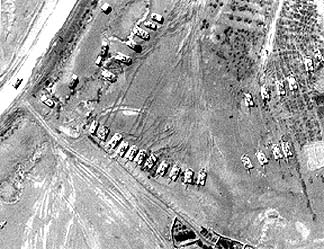
During the 1991 Gulf War,
this KH image located vehicles in the Iraqi Hammurabi Tank Division.
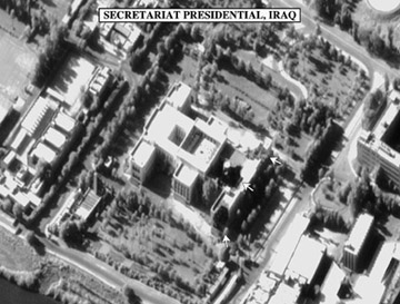
Here is one of Saddam Hussein's
palaces, a potential target in any renewed Iraqi conflict.
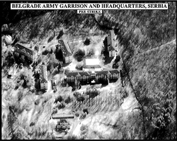
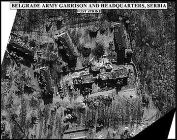
The next pair shows a military
barracks in Serbia before and after an airstrike during the Bosnian conflict.
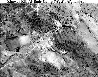
This next image was made
by a KH-12 satellite using an improved Crystal sensor to image the Zawahr Kili
Al-Bahr terrorist camp in western Afghanistan in 1998
Thermal infrared imagery
proved scarce during the writer's Internet search. No photo was identified as
of this type. But here is one which resembles a thermal IR image. It was taken
during the Contra conflict in Nicauragua.
Radar has special military
value because, using the right wavelengths, this active system can "see through"
clouds and can operate at night. The U.S's Lacrosse series consists of a SAR
sensor mounted on a very large (reputed to be schoolbus sized) platform that
ties to extended solar arrays. No Lacross/Vega images were found from an Internet
Search through more than 200 sites - this confirms the highly secretive and
classified nature of this system. The first Lacrosse was orbited in 1988; Lacrosse-4
launched in 2000. The speculation is that this radar can achieve 1 meter or
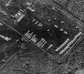
better resolution. The next image was made by an airborne SAR (TIER program)
which simulates the Lacrosse products:
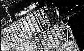
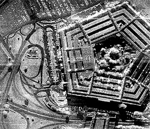
The TESAR (Tactical Enhanced
SAR) program has produced these high resolution images: first of shipping crates
at a Baltimore, MD harbor; second, the most famed military building in the world
- the Pentagon outside Washington. D.C.
Over these past 42 years,
and well before, aerial reconnaissance and intelligence surveillance has relied
heavily on aircraft (ranging from low flying slow single engine propeller planes
to high flying fast jets). A U-2 and an SR-71 example were shown above. In recent
years, the military has turned to another aerial method - the use of UAVs -
unmanned Aerial Vehicles - to conduct pre-programmed surveys of targets and
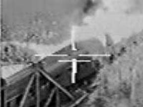
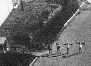
personnel. Some vehicles are called "drones". One class of UAVs is the Predator
series. Below are two examples of images obtained from so-called gun-mounts,
where the camera or sensor is placed at or near the front of the vehicle.
Finally, intelligence imagery
has come full circle. Among the first satellites launched were those used for
military purposes. The experience with this technology was invaluable to NASA
and other space agencies in developing their (until recently, lower resolution)
earth-observers. But, with the Russian declassification followed by orbiting
of civilian commercial satellites, e.g., IKONOS and Quickbird, high resolution
imagery (1 to 4 meter range) has proved to have its military applications and
is being purchased by many nations. The U.S. military and the CIA/NSA complex
have contracted with these companies to obtain imagery, especially since the
9/11 terrorist attacks on the World Trade Center and the Pentagon. We close
with this one example of an Afghanistan Taliban Air Force base at Baghram, north
of Kabul. This is an IKONOS product:
This availability of high
resolution satellite images from unrestricted civilian sources has another important
ramification: Images of possible military value can now be purchased by any
country. Most nations cannot afford their own spy satellite programs but IKONOS,
Quickbird and other private company products are affordable. font face="Arial, Helvetica,
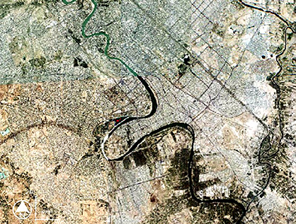
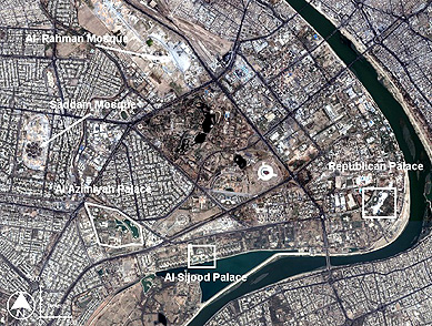
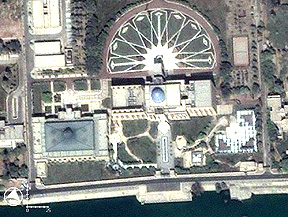
sans-serif">We leave this page with a set of three examples of such imagery
that have been gathered by Quickbird 2 (DigitalGlobe) in its now routine coverage
of Baghdad, Iraq during 2002 and 2003 in anticipation of a possible invasion
of that country by the U.S. military (and, probably other cooperating nations)
as an initiative to topple the government of Saddam Hussein. Read the captions
of each image for details.
So, the question of the
day: Can anything really be private anymore? Finally, for still more
information on security-based surveillance from space, we suggest you check
out the Global Security
Organization web site.
