|
Other
Remote Sensing Systems - IRS, JERS, RESURS, OKEAN, and CBERS Series
|
Other countries are now active in the satellite remote sensing "game". India has launched four satellites, the IRS series, each with multispectral sensors. Japan is operating two satellites, the JERS series, with sensors that cover much the same spectral regions as the Landsat TM, but at higher resolution. The Russians with their RESURS series now offer imagery similar to Landsat and some meteorological satellites. The Ukraine has launched its own OKEAN satellites. China and Brazil have jointly developed the CBERS series. Links to several major American private corporations that sell some of these satellite products are provided.
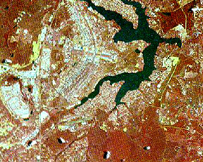
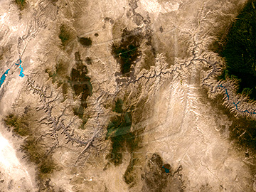
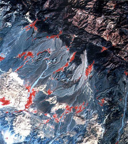
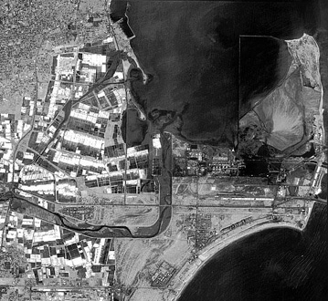
India successfully operates several Earth-resources satellites that gather data in the Visible and Near IR bands, beginning with IRS-1A in March of 1988. The latest in the series, IRS-1D, launched on September 29, 1997. Its LISS sensor captures radiation in the blue-green, green, red, and near IR bands at 23 m spatial resolution. The spacecraft also produces 5.8 m panchromatic images, as well as 188 m resolution wide-field (large area) WiFS multispectral imagery. Below are three recent images from this system, the one on the top (WiFS) showing the Grand Canyon of Arizona, in the middle a three-band color composite made by the 23 m LISS, showing mountainous terrain and pediments with alluvium fans in southern Iran, and at the bottom a 5.8 meter panchromatic view of part of the harbor at Tamil Nadu in India.
More information on the Indian remote sensing program is available from its U.S. distributor, Space Imaging, Inc. (http://www.spaceimaging.com/).
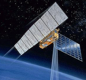
The Japanese, beginning in
1990, have flown JERS-1 and JERS-2 which include optical and radar sensors. Here
is an artist's conception of JERS-1 in space:
The optical system is a seven
band scanner similar in coverage to the TM. The satellites are operated by the
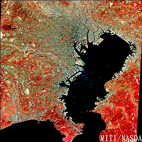
National Space Agency, NASDA. Here is a
false color JERS-1 image of Tokyo and Tokyo Bay:
Starting in the mid 1980s,
the Soviet Union (and now Russia) entered the world arena with an Earth-observing
satellite program available on the open market. The RESURS-01 series (3 so far,
a fourth pending) provided a multispectral system (3 Vis-NIR bands; 2 thermal)
whose resolution (160 m, and 600 m for thermal) is intermediate between that
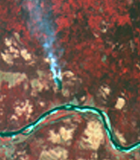
of Landsat/SPOT and the AVHRR on meteorological satellites. Like Landsat RESURS
are placed in near-polar, sun-synchronous orbits. Two images from this system
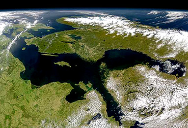
appear below: the first is a false color composite of land near Arkhangel'sk
almost due north of Moscow near the Arctic Circle and the Barents Sea.
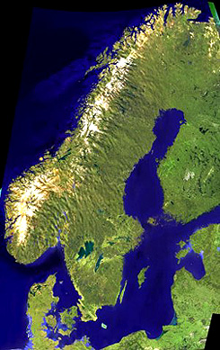
The second RESURS (Resources)
image is part of a mosaic of Europe which here includes all of Norway, Sweden,
and Denmark, and part of Finland and several Baltic nations.
This general region has
recently been scanned by the SeaWiFS sensor or OrbView-2 (see page 14.3) and rendered
as an oblique perspective view:
The National Space Agency
of the Ukraine has its own program of space observations; it works in cooperation
with the Russian Federation in using certain facilities. Its OKEAN series includes
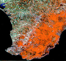
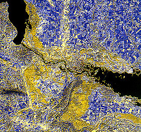
multispectral scanners, thermal sensors, and radar. Two MSU-V images (50 m resolution)
show a standard false color composite (left) of the southern Crimea (Sebastapol
in lower left) and a different color combination (right) of the Dnieper River
in the Ukraine Lowlands, with Kiev just below the upper "lake" (caused by river
damming).
The Peoples Republic of
China has joined forces with the Brazilian government to develop a series of
earth-observing satellites launched by Long March rockets from China. Their
program goes by the name of CBERS (China-Brazil Earth Resources Satellites);
in China these satellites are called the Zujuan series. CBERS-1 was orbited
on October 14, 1999. It includes three sensors: 1) WFI (300 km swath; 260 m
resolution; 4 bands); 2) IR-MSS (20 km swath; 80 m resolution; 4 bands including
thermal); and 3) CCD (20 m resolution; 4 bands). The more than 280000 images
received are concentrated mainly over Brazil and China and are not generally
available to other nations. CBERS-2 (YZ-2) was launched on September 1, 2000;
although reputed to be available for earth resources applications, western observers
have concluded that its 3-meter resolution sensor is being used primarily for
military reconnaissance. Here is a CBERS-1 CCD image of an (unidentified) area
in Brazil: