

GEOGRAPHIC
INFORMATION SYSTEM (GIS)
Components of GIS
A working GIS integrates five important components: hardware, software, data and people or technical expertise.
Hardware
Hardware
is the computer on which a GIS operates. Today, GIS software runs on a wide
range of hardware types, from centralised computer servers to desktop computers
used in stand-alone or networked configurations.
Software
GIS software provides the functions and tools needed to store, analyse and
display geographic information. Key software components are
Data
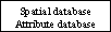
The most important component of a GIS is the data, geographic and related
tabular data (spatial and
non-spatial data). GIS will
integrate spatial data with other data resources and use DBMS to organise and
maintain the spatial data. The following are the more common data that are
encountered:
Digital Elevation Model (DEM)
A DEM is a set of digital topographic data that can be developed from contours of an area. It is done by the rasterisation of the vector contour file. DEM’s provided by United States Geographic Survey (USGS) typically follow the 7.5-minute quadrangles of USGS topographic series.
Triangular Irregular Network (TIN)
A TIN is an organisation of spatial information based on a set of irregularly shaped triangles that form a connected network. TIN is used to efficiently organise surface data with minimal redundancy.
Digital Line Graph (DLG)
They are also developed by USGS. The data are vectors based in the form of digitised lines at a scale of 1:100,000. DLGs are available for several categories of data including contours roads and rivers.
Topographically Integrated Geographic Encoding Referencing (TIGER)/LineÒ files
TIGERÒ is the name for the system and digital database developed by US Census Bureau to support its mapping needs for the decennial census and other census programs.
Technical Expertise
GIS technology is of limited value without trained technical experts who manage the system and develop plans for applying it to real-world problems. GIS users range from technical specialists who design and maintain the system to those who use it to help them perform their everyday work.
Flowchart of the components of GIS
| Maps | Images | Statistical report |
|
|

|
|
 |
||
|
|
|
|
| Maps | Spatial Data | Statistical Data |
Cartographic
display system
This system allows users to select and extract a particular database or map output on the screen or printer etc.
Map
digitising system
This system enables users to convert existing paper maps to digital form, further aiding in developing database.
Database management system
This
system has the ability to analyse the attribute data. Term "attribute"
refer to qualities or characteristics of places with spatial and location
information.
· Software, which provides cartographic display, map digitising and database query capabilities, are often referred to as automated mapping facilities management (AM/FM) systems.
Geographic
analysis system
This component has the ability to analyse the truly spatial characteristics. Term "spatial" refers to any two or three-dimensional data whether or not it relates directly to the surface of the earth.
Image
processing system
It helps to analyse and classify the remotely sensed images (digital images) according to various classification techniques, which could be interpreted with the help of training data.
Statistical
analysis system
This helps in statistical analysis of spatial and temporal data, which is required in scenario analyses.


