Place |
Distance from Moodbidri |
Place history |
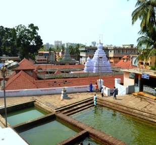
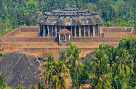
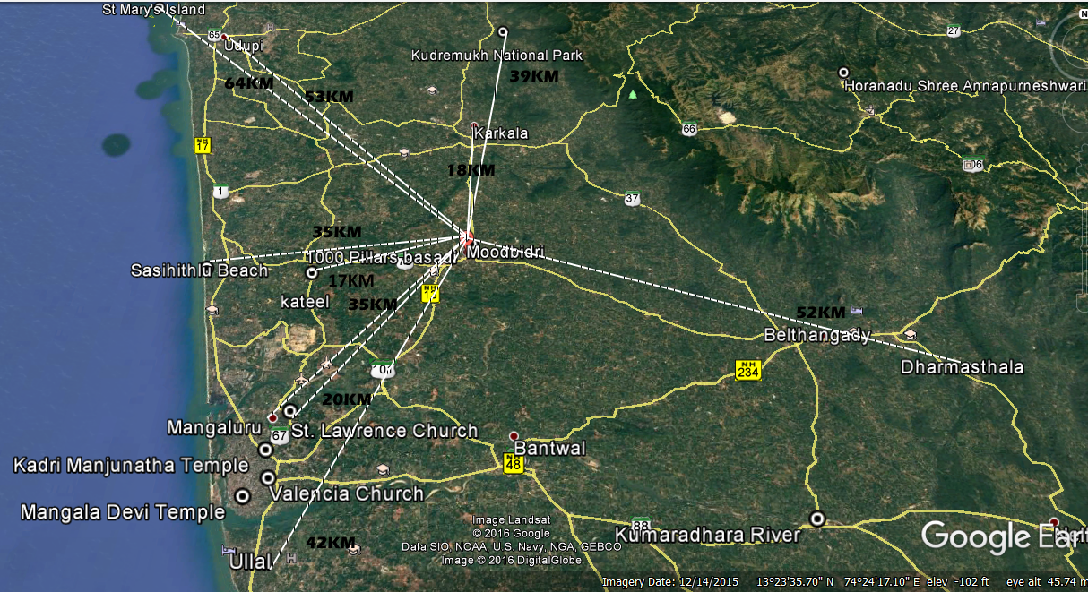
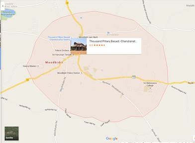
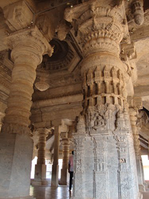
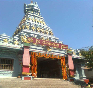
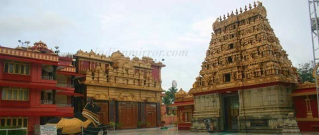
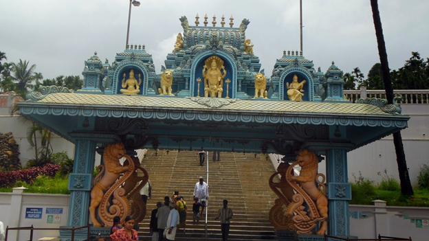
Saavira Kambada Basadi |
39km |
Saavira Kambada Basadi, also known as 1000pillar Jain temple located in Moodabidri town itself. The temple was built by Devaraya Wodeyar (vijayanagara-Hampi), in 1430. The shrine has a 60 feet tall monolith manasthambha (erected by karkala bhairava Queen Nagala Devi). |
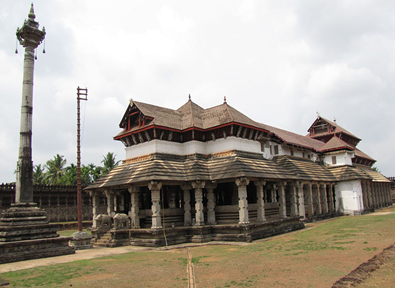
There are other Basadi's namely Ammanvara Basadi, Leppada Basadi, Vikram Shetty Basadi, Mahadeva Shetty Basadi, Chola Shetty Basadi, Koti Shetty Basadi, Derma Shetty Basadi etc. Almost all are situated in and around Basadi road of Moodabidri.
Place |
Distance from Moodbidri |
History |
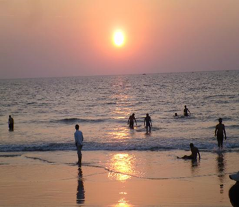
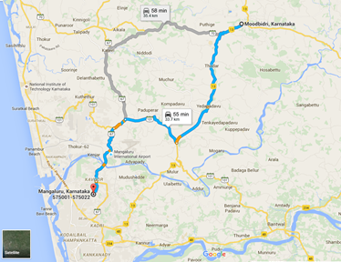
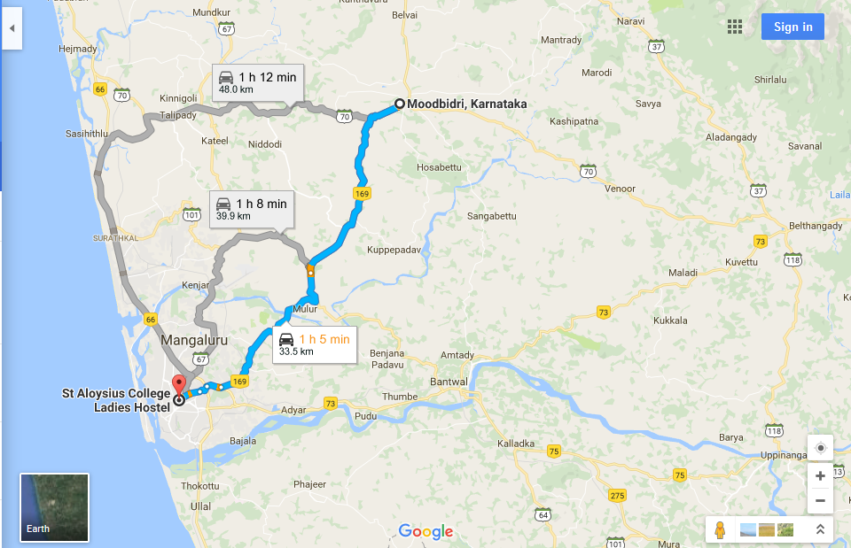
Mangalore |
35k |
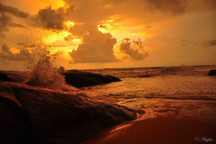
Mangalore (or Mangaluru) is an Arabian Sea port and a major commercial center in the Indian state of Karnataka. It's home to the Kadri Manjunath Temple, known for its bronze statues, and the 9th-century Mangaladevi Temple. Its Catholic sites include Milagres Church, dating to the 17th century, and St. Aloysious Chapel, which features interior paintings. Tannirbhavi Beach is popular for its sunset views |
MANIPAL COLLEGE
Place |
Distance from Moodbidri |
History |
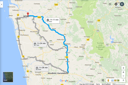
Manipal |
52km |
The Manipal College of Dental Sciences, Manipal, also known as MCODS, was established in 1965 and received accreditation by the Dental Council of India in 1970. It was India's first private dental college and 14th dental college. It is a Manipal University (formerly known as MAHE) constituent college. In 1953, T.M.A. Pai founded India's first private medical school, Kasturba Medical College,[9] and five years later the Manipal Institute of Technology was formed. Ramdas Pai took over the management in 1979 after the death of T.M.A. Pai. Initially all degrees were awarded by Karnatak University Dharwad and later Mysore University. From 1980 to 1993 they were awarded by Mangalore University. The current organizational structure was formed in 1993, when Manipal University (then known as the Manipal Academy of Higher Education) was accorded deemed university status by the University Grants Commission. |
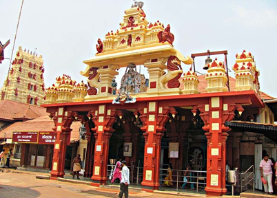
KADRI MANJUNATHA TEMPLE
Place |
Distance |
History |
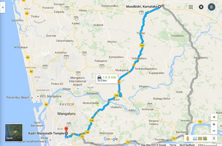
Kadri Manjunatha Temple |
30km |
The temple of Manjunatheshwara on the hills of Kadri is a very beautiful and popular temple in Mangalore. It is said to be built during the 10th or 11th century. It was converted to a complete stone structure during the 14th century. The idol of Lord Manjunathaswamy of the temple is called as oldest of the South Indian Temples. It is believed that Parashurama who was living in Sahyadri, killed the kshathriyas who were cruel and donated the lands to Kashyapa. He prayed to Lord Shiva for a place to live. Lord Shiva assured Parashurama that if he performed a penance at Kadali kshethra, Lord Shiva would reincarnate as Manjunatha for the betterment of the world. As per Shiva's orders Parashurama threw his axe into the sea and created a place for his penance. Yielding to Parashurama's prayers Lord Shiva appeared to him as Manjunatha along with Goddess Parvathi and stayed at Kadri for the betterment of the world. As per the orders of Manjunatha the sapthakoti manthras become the seven theerthas. |
 |
|
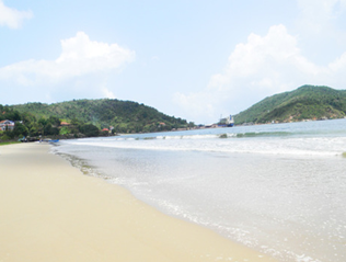
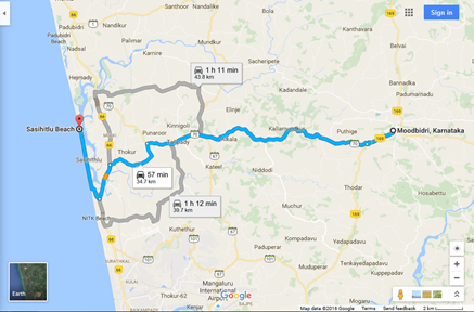
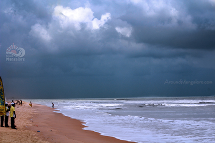
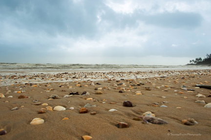
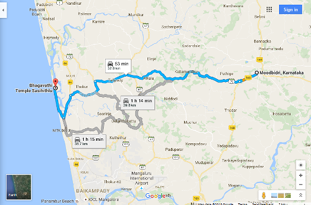
SASIHITLU BEACH
Place |
Distance from Moodbidri |
History |
Sasihitlu |
35km |
The place, Sasihithlu, appears less known to the masses and thus has remained virgin so far. The confluence of the two rivers with the sea has created an entirely different world with its own enchanting beauty. From Sasihithlu village, one has to take the kutcha road passing amidst an acacia grove to reach the beach. |
 |
 |
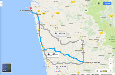
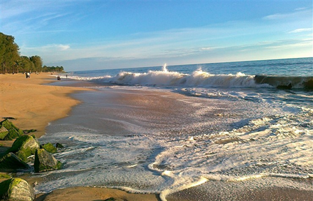
MALPE BEACH
Place |
Distance from Moodbidri |
History |
Malpe Beach |
61KM |
Malpe is a natural port about six kilometers to the west of Udupi, Karnataka, India. An important port and fishing harbor on the Karnataka coast. It is a suburb in Udupi city. Malpe and the Mogaveera goes together. Malpe is a hub of Mogaveera population. Inhabitant for the millionaire businessmen of Mogaveera community. Tulu, Kannada and Konkani are spoken here.[1] first Indian beach with 24/7 WiFi |
|
|
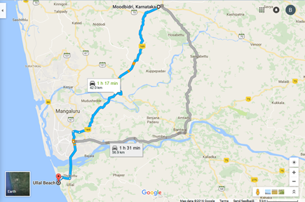
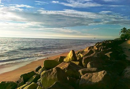
ULLAL BEACH
Place |
Distance from Moodbidri |
History |
Ullal Beach |
42km |
Ullal is a City Municipality in Mangalore Taluk in Dakshina Kannada district. It is a small city about 8–10 km south of Mangalore city center close to the border between the two southern states of Karnataka and Kerala. The Mangalore International Airport is 24 km away from Ullal. It comprises two revenue divisions, Ullal and Permannur, in Mangalore Taluk. Ullal is adjacent to City Corporation of Mangalore, 10 km from District headquarters - Mangalore. |
 |
 |
 |
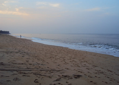 |
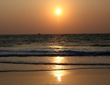
THANNIRBAVI BEACH
Tannirbhavi (also spelled as Tannirbavi) is one of the popular beaches in Mangalore city, and comes second in popularity to the nearby Panambur beach. Tannirbhavi beach has some basic facilities like life guards, proper toilets, a parking lot, a couple of small eateries and some concrete benches. On the other side of the land strip of the beach there is a barge-mounted 220 MW power plant set up by the GMR group.It is located at a distance of 12 km from Mangalore.
|
|
MANGALA DEVI TEMPLE
Place |
Distance |
History |
Managala Devi Temple |
36km |
The Mangala Devi Kannagi temple is located on the border of Tamil Nadu and Kerala. It is located about 7 km from Pazhiyankudi in Theni district and 15 km from kkadi of Idukki District, Kerala. Cheran Chenguttuvan, the king of ancient Tamilakam, had erected the temple for Kannagi around 2000 years back at Vannathiparai and called it Kannagi Kottam or Mangaladevi Kannagi temple and performed regular pujas. Its sits at an altitude of about 1337m above the sea level. It is surrounded by lush greenery and is closed throughout the year except during the Chitra Pournami festival. At other times tourists can still view it by getting a special letter from the forest ranger. The view from the temple premises is spectacular and one can see part of eastern ghats and some villages from adjacent state of Tamil Nadu. |
UDUPI
Place |
Disatnce from Moodbidri |
History |
Udupi |
53km |
Udupi a land of ethereal beauty also known as an ancient temple city, located 57 km from Moodbidri, known for Udupi Krishna mutt (a holy temple of Sri Krishna and this is the birthplace of Sri Madhwacharya, founder of Dwaita Philosophy http://www.udipikrishnamutt.com/), Guddattu Vinayaka temple (Jaladhivasa Ganapathi unique temple runs back for about 700 years), Suparsha Cave (tri-shakti linga - Kali, Lakshmi, Saraswathi, the 3 separate lingas), Malpe Beach, Trasi Maravanthe Beach and Mattu Beach. Chandramouleshwara Temple is another Udupi Attractions which is dedicated to Lord Shiva and other places include Hasta Shilpa, Anatomy Museum, Heritage village, End Point, Anantheshwar Temple and Smrithi Bhavan. |
 |
 |
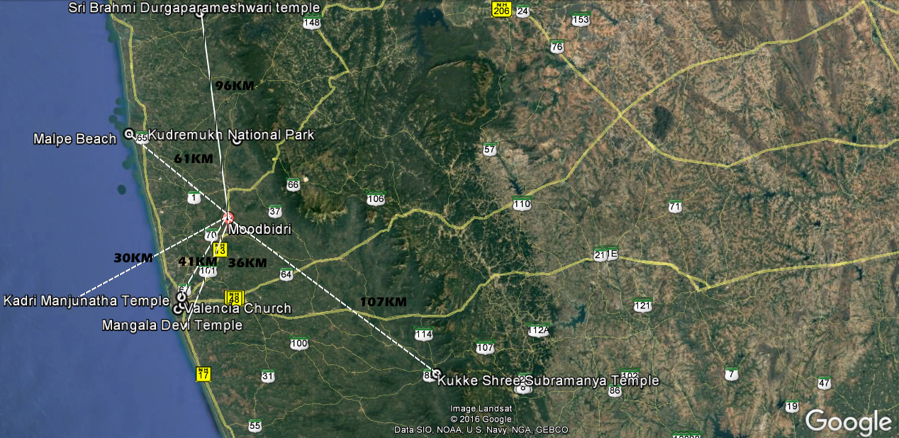
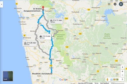
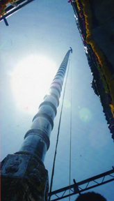
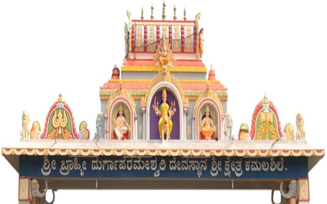
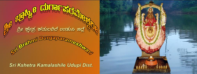
SRI BRAHMI DURGAPARMESHWARI (KAMALASHILE)
Place |
Distance from Moodbidri |
History |
Sri Brahmi Durgaparmeshwari |
96km |
Kamalashile is located at a distance of 35km from Kundapura in Udupi district. Kamalashile is surrounded by beautiful mountains and evergreen forests with the river Kubja flowing by the side of it. Kamalashile is famous for its ancient . |
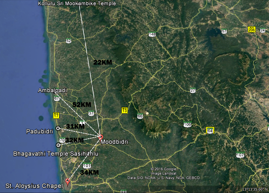
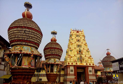
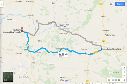
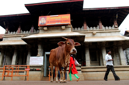
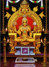
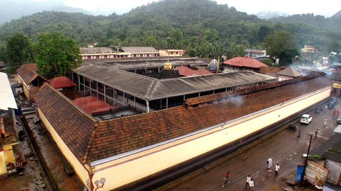
KOLLURU SRI MOOKAMBIKE TEMPLE
Name |
Distance |
History |
Kolluru Sri Mookambika temple |
22km |
The Kollur “Shree Kshntram”, situated in the Udupi Disctrict of Karnataka State, is one among the seven abodes of Salvation, in the creation of Parashurama. Mookambike is an Adi Shakthi as the Linga has integrated on it’s left side “ MahaKali”, Maha lakshmi” and Maha Saraswathi”. The Adi Shakthi in this form can be seen only here. In the form of Udhbhavalinga, Mookambike has also integrated Brahma, Vishnu and Shiva on the right side. A gold Chain is dividing this Jyothirlinga into left and right portion. The left side of the Linga represents the Shakthi and right represents Shiva. Since Devi had appeared in his devine sight during his meditation, Adi Shankara had set up the statue of Devi on “SriChakra Yantra”. Shri Shankaracharya's Peetha is on the western side of the Sactum Sanctorum of the Temple. Even today the worshiping ritual is being continued as per the Vijayagama system formulated by Adi Shankaracharya |
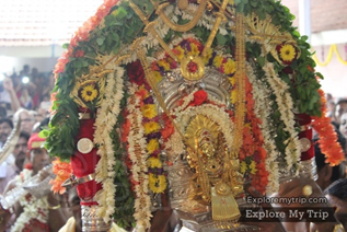
SASIHITHLU BHAGAVATHI TEMPLE
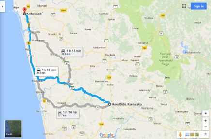
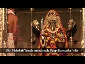
AMBALPADI
Name |
Distance |
History |
Ambalpadi |
52km |
Ambalpady/Ambalpadi is a holy place which is part of Udupi town, the land of Lord Sri Krishna. With the ancient Sri Janardana temple with Mahakali Temple on one side, Janardana pushkarani in the front, an Anjaneya temple with an idol incorporating incarnations of Mukhyaprana, and a Brandavan of Raghavendra Swamji in the surroundings, it is growing as a religious and cultural center in the coastal belt of Karnataka. |
PADUBIDRI
Place |
Distance |
History |
Padubidri |
31km |
Padubidri or Padubidre or Padubedre in Tulu language is a small town in coastal district of Udupi in Karnataka state, India. Padubidri is on the way from Udupi to Mangalore route. National Highway 17 (now NH 66) passes through Padubidri. Padubidri is famous for ritual Dakkebali, which is held every two years. This ritual is held in odd series of years 2005, 2007 and so on.The Nandikoor thermal power plant also known as Udupi thermal power plant is nearby. |

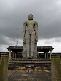
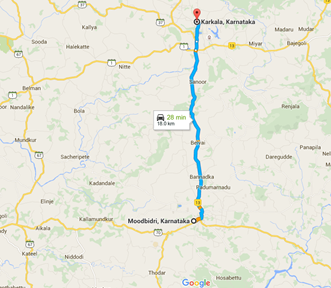
KARKALA
Name |
Distance |
History |
Karkala |
18km |
Karkala town located 18km from Moodabidri and well known for Anatha shayana temple, Chaturmukha basadi, Venkateshwara temple. Karkala is in north-east of Mangalore, known primarily for the statue of Lord Bahubali (Gomateshwara). The 45-feet tall statue is estimated to weigh 80 tons. |
|
|
|
|
Gommateshwara statue at Karkala |
|
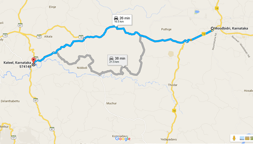
KATEEL
Name |
Distance |
History |
Kateel |
17km |
Kateel Sri Durgaparameshwari Temple, located 17 km from Moodabidri town, well connected with Bus and private transport vehicles. The holy temple is situated on an islet in the middle of the sacred river Nandini amidst panoramic scenes and fascinating greenery. For more information visit http://kateeldevi.in/. |

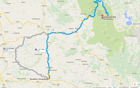
KUDREMUKH NATIONAL PARK
Place |
Distance from Moodbidri |
History |
Kudremukh |
39km |
The Kudremukh National Park is one of the most popular tourist place. The park is situated in the lush green environs of the Western Ghats and sprawls over an area of 600 sq km. The National Park has four mountain ranges namely, the Kudremukh, the Kerekatte, the Kalasa and Shimoga ranges. Kudremukh National Park is under the Global Tiger Conservation Priority I, which has been developed by the Wildlife Conservation Society and World Wide Fund, USA. The rivers Nethravathi, Tunga and the Bhadra originate within the Kudremukh National Park. A temple of goddess Bhagavathi is also situated within the park. |
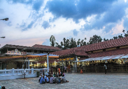
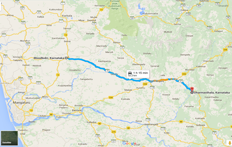
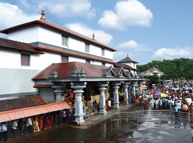
DHARMASTHALA
Place |
Distance from Moodbidri |
History |
Dharmasthala |
52KM |
Dharmasthala (http://www.shridharmasthala.org/) is an temple town on the banks of the Nethravathi River in the Belthangadi taluk of the Dakshina Kannada district. Dharmasthala Shri Manjunatha Swamy Temple, represents religious tolerance here, the Jain Theerthankara is worshipped on the same consecrated grounds as the native Daivas and Lord Manjunatha (Lord Shiva). Other places include Shri Chandranatha Swamy Temple, Shri Annappa Swamy Betta, Shri Bahubali Hill, S.D.M.Oriental Library, Manjusha Museum, Vintage Car Museum, Jama Ugrana, Acquarium. |
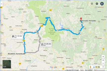
HORNADU
Place |
Distance from Moodbidri |
History |
Hornadu |
92KM |
Hornadu is a Hindu holy locale and panchayat village located in Chickmagalur district, Karnataka, India. The deity at the Annapoorneshwari Temple at Hornadu is Annapurneshwari. The main deity of the goddess was put in place by Adi Shankaracharya; the new deity of goddess Annapurneshwari was consecrated in the temple in 1973. Hornadu lies amidst beautiful Malnad at a distance of 330 KM from Bengaluru. Distance from Sringeri is 75 Kilometers. |
|
|
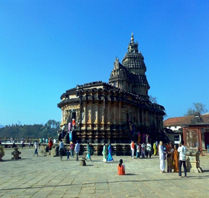
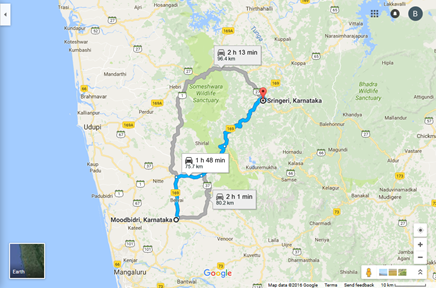
SRINGERI
Place |
Distance from Moodbidri |
History |
Sringeri |
76KM |
Sringeri is a hill town and taluka headquarters located in Chikkamagaluru district in the state of Karnataka, It is the site of the first maṭha (Sringeri Sharada Peeta) established by Adi Shankara, Hindu theologian and exponent of the Advaita Vedanta philosophy, in the 8th century CE It is located on the banks of the river Tungā and also a historical Temple (1200 years). |
|
|
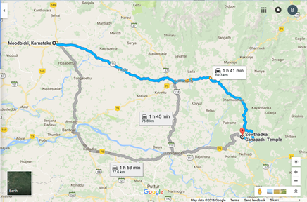
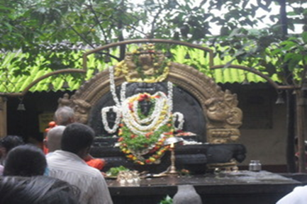
SOWTHADKA GANAPATHI TEMPLE
Name |
Distance from Moodbidri |
History |
Sowthadka Ganapati Temple |
70km |
The uniqueness of the place is Lord Maha Ganapathi is out in the open field without a 'Garbha gudi' and temple structure. It is surrounded by greenery and open round the clock for offering prayers. About 35km from Kukke Subramanya Temple is 'Southadka Shree Mahaganapathi Kshetra' in the interiors of Kokkada. This is about 16km from Dharmasthala. The temple is decorated with lot of Bells mainly, offered by worshippers who have special wishes. One can find lot of monkeys inside the temple. |
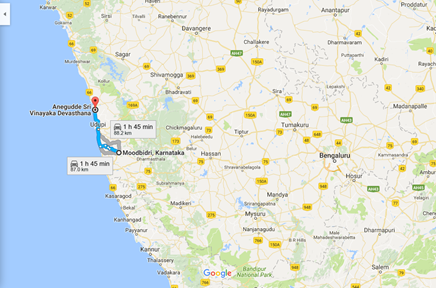
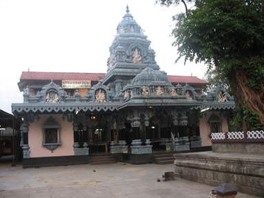
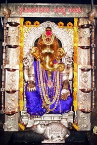
ANEGUDDE SRI GANPATHI TEMPLE
Place |
Distance from Moodbidri |
History |
Anedudde |
87km |
Anegudde is a village in the Kundapura taluk of Udupi district, India. The village is also known as Kumbashi . It lies en route from Udupi towards Kundapura on the NH 66. One of the best known Ganesha temples in Udupi District is that of Shri Maha Ganapathi at Anegudde. Anegudde is one of the seven ‘Mukti Sthalas’ (Parashurama Kshetra)in coastal Karnataka. |
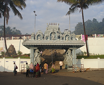
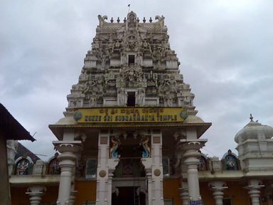
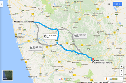
KUKKE SHREE SUBRAHMANYA TEMPLE
Place |
Distance from Moodbidri |
History |
Kukke Shree subrahmanya |
107KM |
Kukke Subramanya (Tulu and Kannada Kukke subrahmaṇya) is a Hindu temple located in the village of Subramanya, Karnataka Here Kartikeya is worshipped as Subramanya, lord of all serpents. The epics relate that the divine serpent Vasuki and other serpents found refuge under Subramanya when threatened by the Garuda. The Kukke Subramanya Temple is located in the beautiful Western Ghats range of Karnataka. Overlooking the temple is the famous mountain of Kumara Parvatha, a popular hiking destination for trekkers from across South India. |
|
|
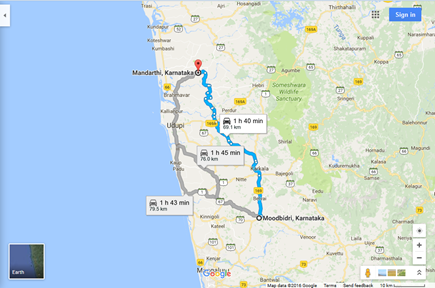
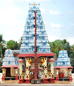
MANDARTHI
Place |
Distance from Moodbidri |
History |
Mandarthi |
69km |
Mandarthi is a Hindu holy place located 25 km north to Udupi in the Udupi District of Karnataka state, India. The Goddess Sri Durgaparameshwari Temple resides here.[1] The name derives from 'Manda-Aarathi' from Kannada, meaning the holy light. |
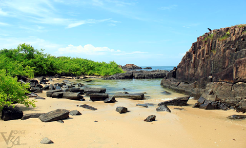
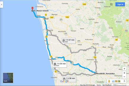
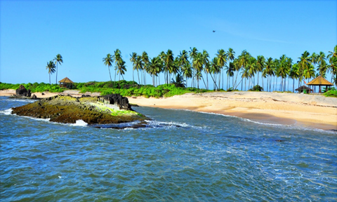
ST. MARY’S ISLANDS
St. Mary's Islands, also known as Coconut Island and Thonsepar, are a set of four small islands in the Arabian Sea off the coast of Malpe in Udupi, Karnataka, India. They are known for their distinctive geological formation of columnar basaltic lava (pictured). Scientific studies indicate that the basalt of the St. Mary's Islands was formed by sub-aerial subvolcanic activity, because at that time Madagascar was attached to India. The rifting of Madagascar took place around 88 million years ago.The islands form one of the four geological monuments in Karnataka state, one of the 26 Geological Monuments of India declared by the Geological Survey of India in 2001. The monument is considered an important site for "Geo Tourism"
 |
|
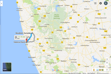
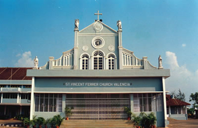
VALENCIA CHURCH
Place |
Distance |
History |
Valencia Church |
41.5km |
St Vincent Ferrar parish of Valencia situated at Kankanady locality of Mangaluru city has been very popular parish because of its distinct identity. The key objective of this article lies in giving a brief history of parish that is at the threshold of diamond jubilee celebrations. |
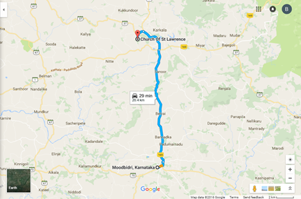
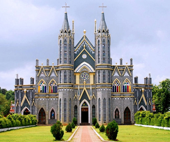
ST. LAWRENCE CHURCH
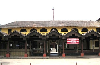
St. Lawrence Shrine or Attur Church (Portuguese: São Lourenço de Carcoal, English: St. Lawrence of Karkala) is a Roman Catholic church in Karkala. It came into existence in 1759 and has a history of miracles. It is by characterized its Attur Jatre or Attur Fest (Attur festival). Placed amidst placid greenery, the Attur-Karkala parish has a rich history with its origin tracing back to 1759. Moreover it is known for its miraculous history. Miracle, history, beauty, social activities, all bundled into one. Unlike others, the church is a place of worship and belief for all, irrespective of caste and creed. An vidence for universal peace and brotherhood. People from all walks of the society come here to offer their prayers to St Lawrence. The church is another name for repose but enthusiastic to carry out social activities. It accomplishes its responsibility to the society silently. The Church has a school and an orphanage under its patronage.
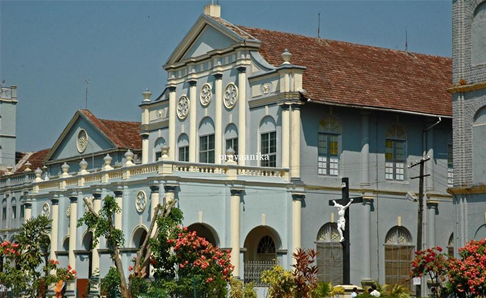
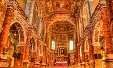
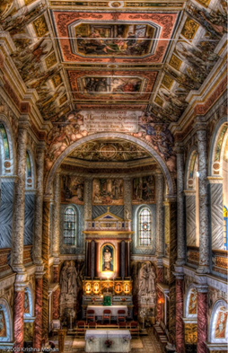
ST. ALOYSIUS CHAPEL
NAME |
DISTANCE |
HISTORY |
St. Aloysius chapel |
34km |
The St. Aloysius Chapel in Mangalore was built by Jesuit Missionaries in 1880 and its interiors painted by the Italian Jesuit Antonio Moscheni in 1899, during the Mangalore Mission in 1878. The Italian Jesuits played an important role in education, health, and social welfare of the Mangalorean Catholic community[1] and built the St. Aloysius College in 1880,[2] St Aloysius Chapel in 1884,[3] and many other institutions and churches. |
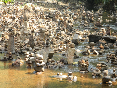
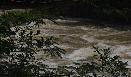
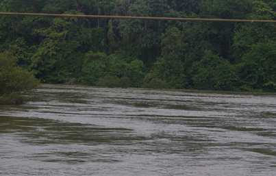
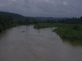
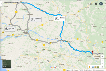
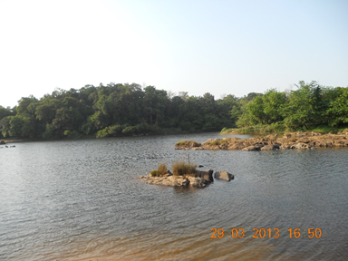
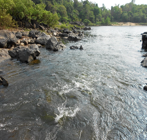
GUNDYA RIVER
|
|
|
Gundya River
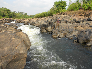
Kukke and Kumaradhara Junction
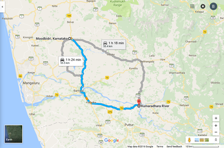
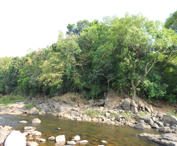
KUMARADHARA RIVER
 |
 |
 |
 |
|
|